The Verdugo mountains are a small segment of the Transverse Ranges that stretch east-west across LA County and beyond. They’re perched a little south of the western end of the San Gabriel mountains, nestled between Glendale and Burbank. And in my view, they’re the best vantage point if you want dramatic views of the city of Los Angeles and both its natural borders: the glinting Pacific and the lofty San Gabriels. They’re much wilder and quieter than Griffith Park, and they give a better in-the-midst-of-things perspective than the Santa Monica mountains or Will Rogers and other parks closer to the ocean.
I’ve already blogged about the Beaudry motorway loop, the first Verdugo route we ever tried, back in the spring of 2017 when we were still getting a feel for LA hiking. And I wrote up a more ambitious birthday route from December 2024—I think my top rec for a keen walker new to LA and wanting to get a Day 1 sense of the city before venturing into the San Gabriels. (Day 2 would then be the delightful Josephine!)
I walked a lot in the Verdugos when staying in a lovely Airbnb right on the edge of them for six weeks in the spring of 2022. (I booked for four weeks and then extended for another two because I couldn’t bear to leave yet.) I’d often stop work in the mid-afternoon and choose a new route to take, sometimes setting off on foot right from my front door, other times driving a little way to try a new trailhead.
In this post, I give an overview of some of my favourite variations from that time. I’m writing them up nearly four years after the fact, and I took no systematic notes, so even more than all the others, this one is meant as tempting inspiration rather than as directions to follow. I’ll quote now and then from my diary entries to give you a flavour of how I experienced these walks, and I hope that knowing at least the starting points will give you a sense of how to embark on your own explorations.
This page includes:
- Beaudry North & South Motorways
- Beaudry South motorway
- Beaudry trailhead to Oakmont View Drive via Verdugo Peak
- Stough canyon #1 and #2
- La Tuna Canyon trail
- Whiting Woods to Verdugo Peak
- and (not actually in the Verdugos!) Deukmejian Wilderness Park
Beaudry North & South Motorways
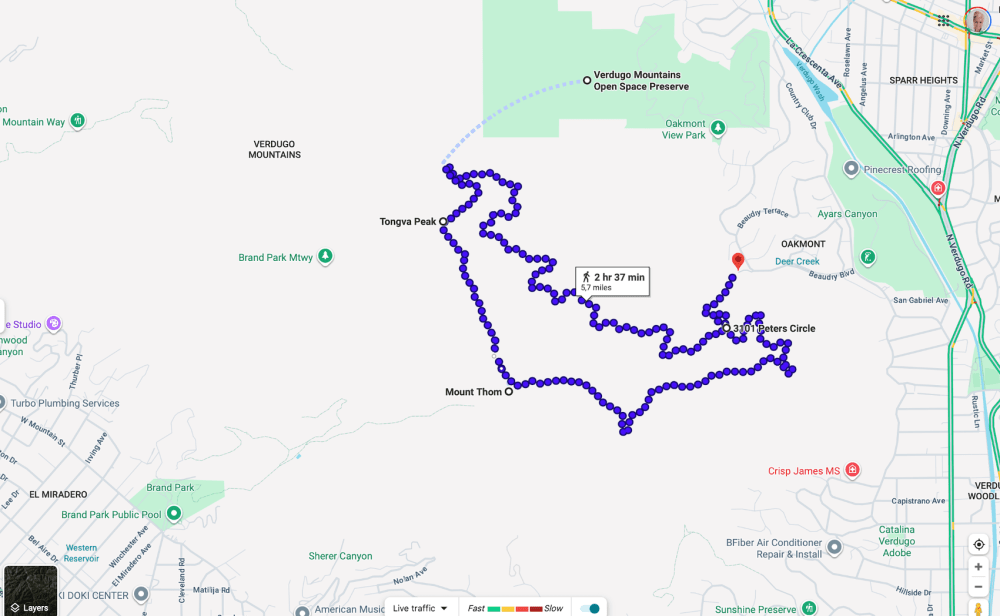
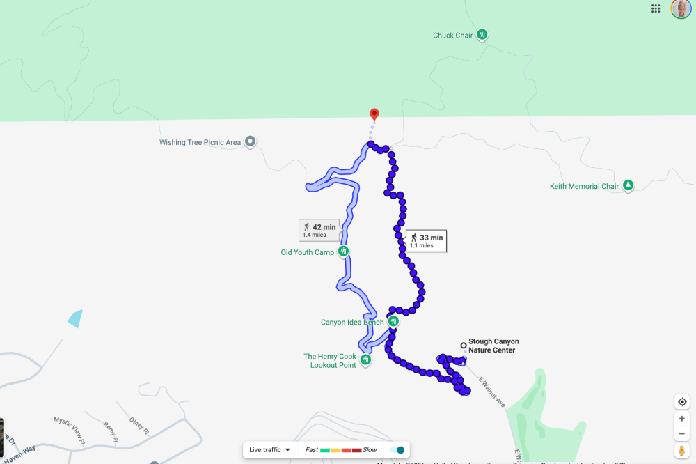
This is the one I linked to above, a 5.7 mile loop from the eponymous Beaudry Loop trailhead (my closest-to-home in 2022), which Google and that writeup suggest will take around 2.5 hours and my photo timestamps from this time suggest a bit less.
Here’s a Google Maps overview (slightly misleading in that you don’t actually go to Tongva Peak; it’s on a separate little spur that has so far never felt worth doing):
Here’s me waxing lyrical about it in my diary the morning after:
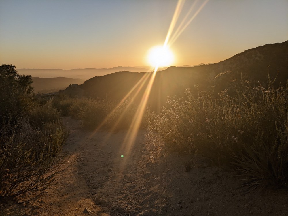
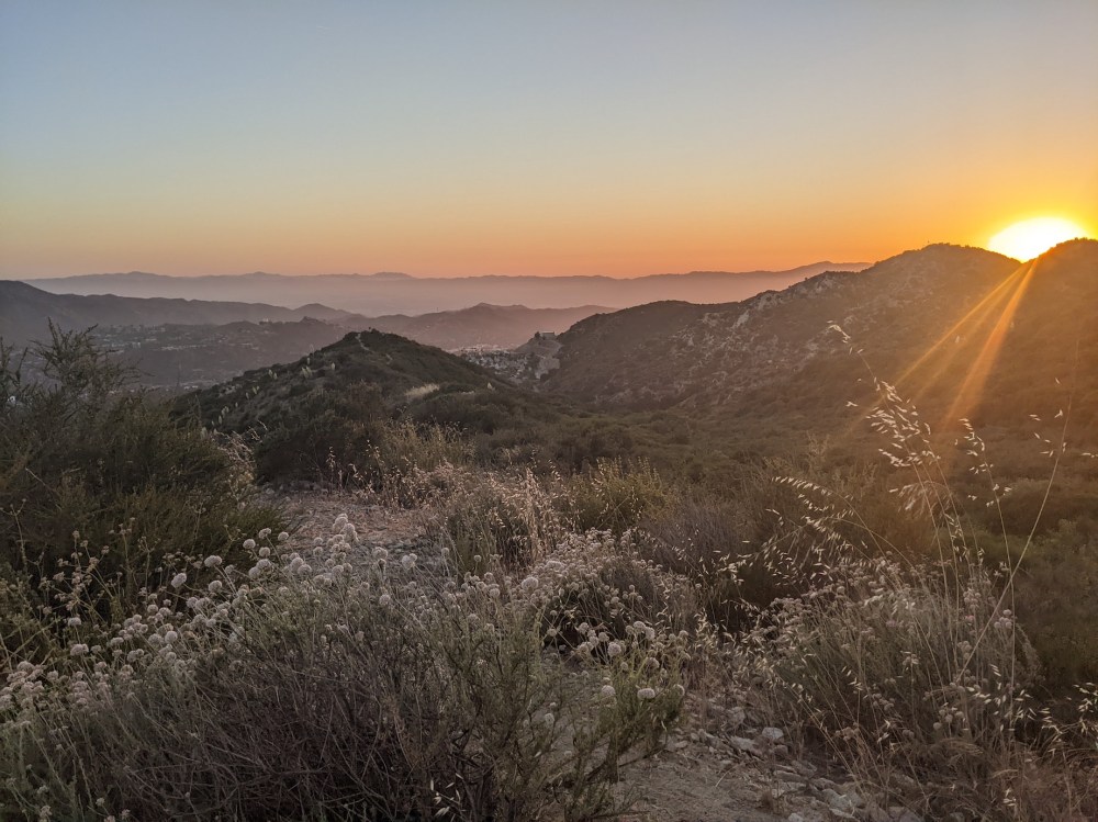
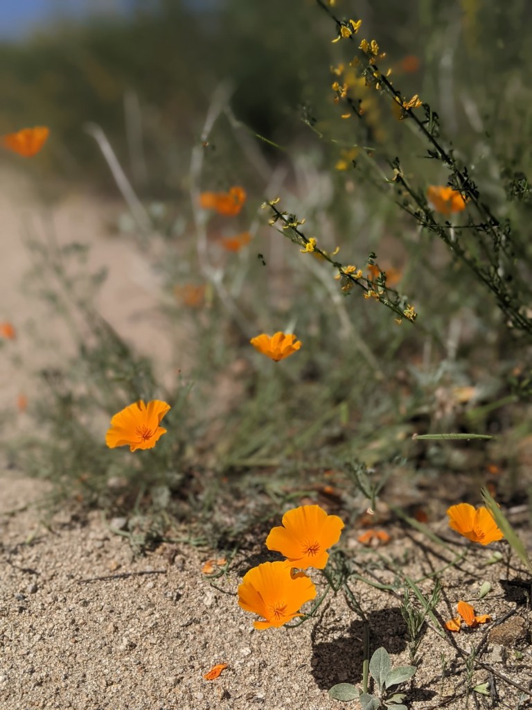
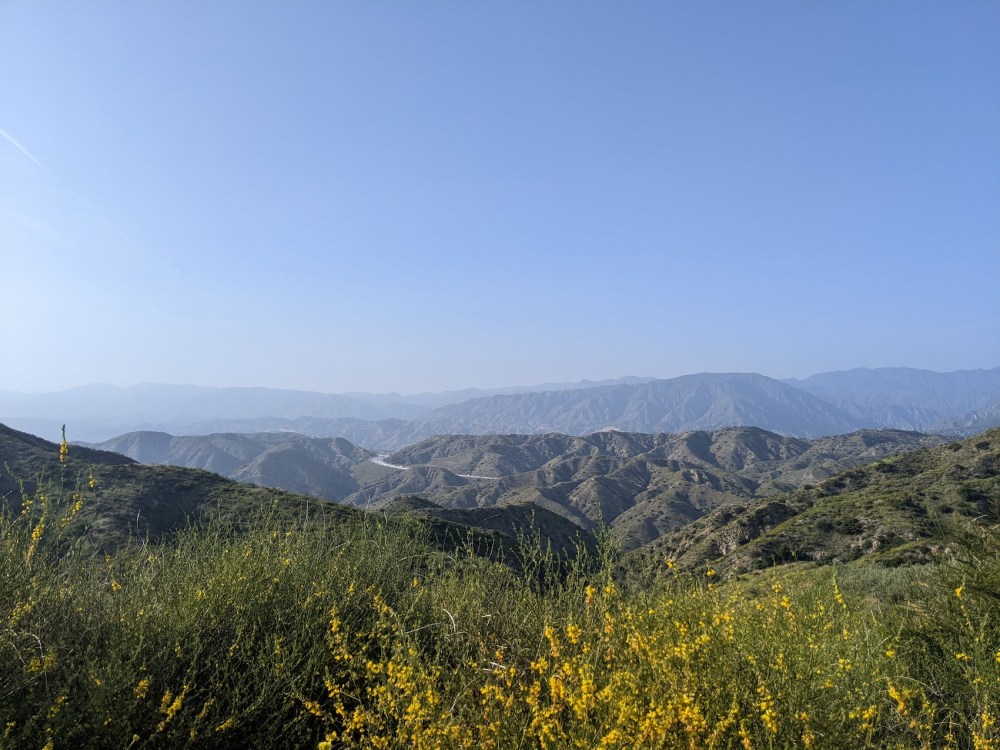
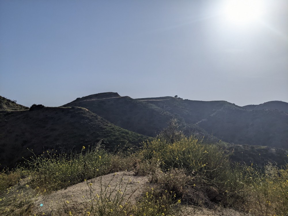
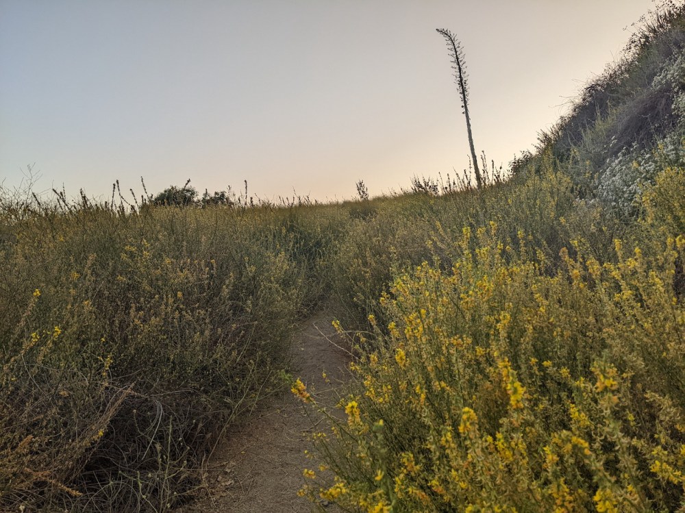
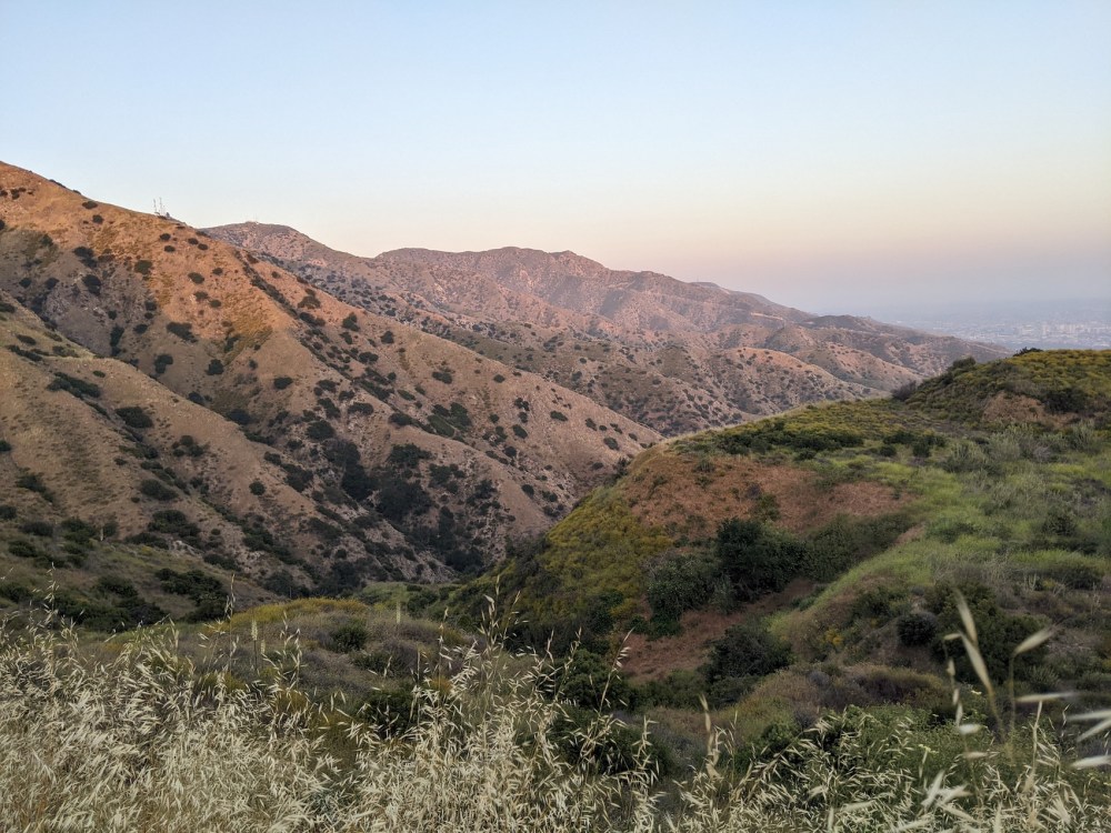
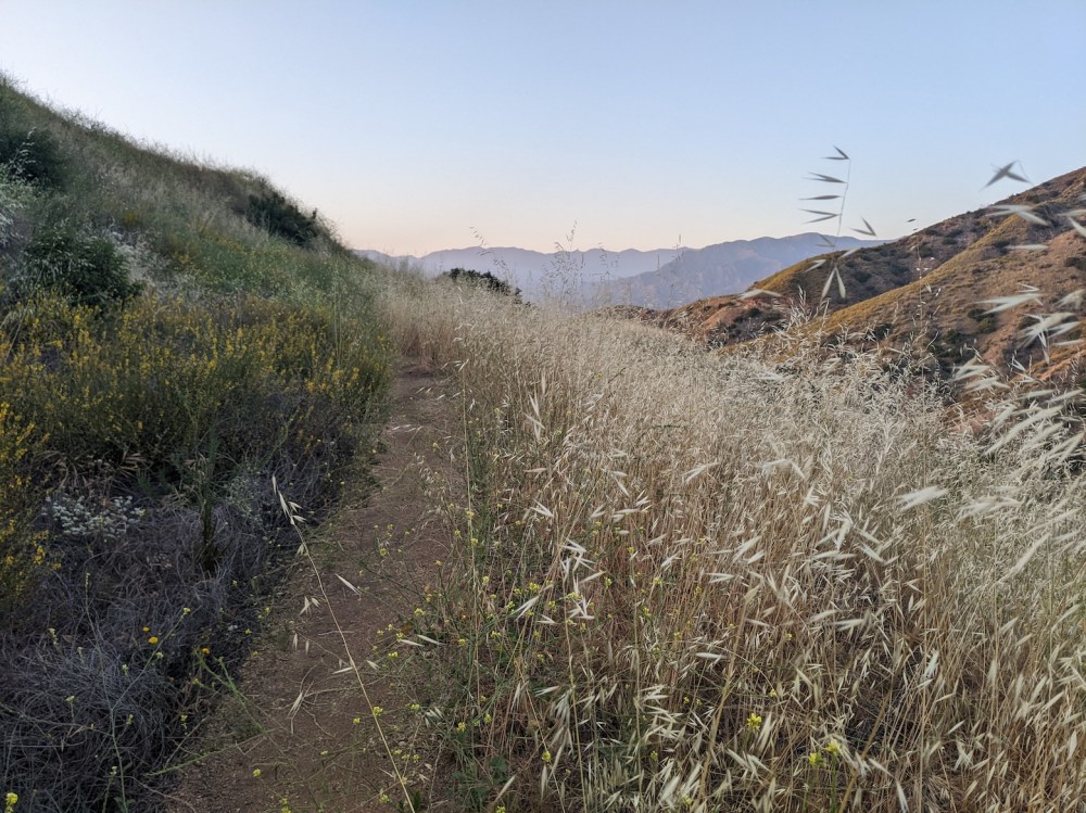
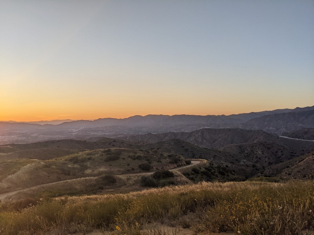
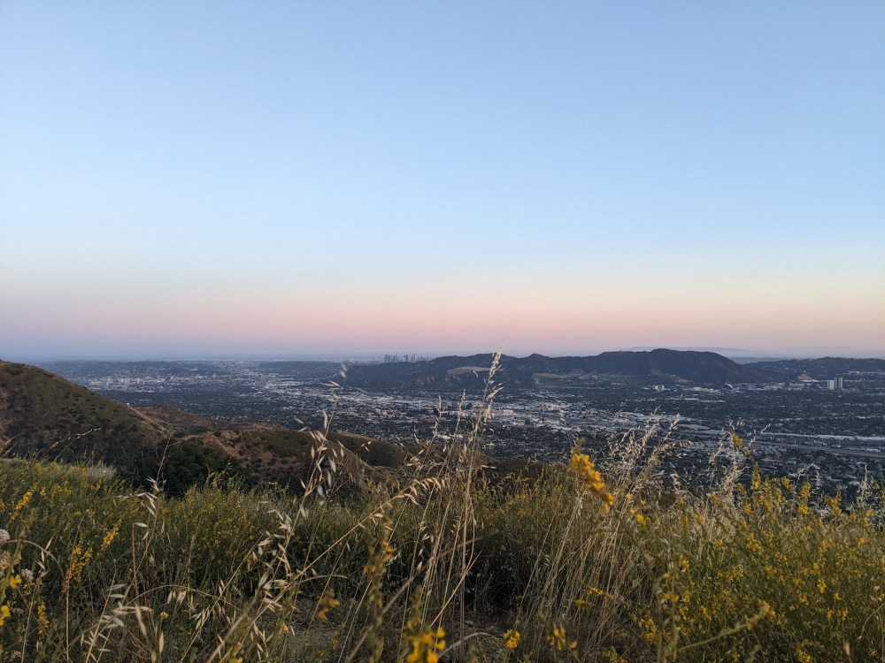
25 April 2022: there are clouds this morning but the San Gabriels are looking nearly as majestic as they did on my mid-afternoon/“lunchtime” hike yesterday, as they unfolded bit by bit on my steady traverses up Beaudry Motorway North, and Strawberry and Josephine and Wilson and San Gabriel Peak and Mt Disappointment and all the other old friends some of whose names I couldn’t work out came gradually into view, and then once I got past the masts and onto the South Motorway, downtown in all its defiant majesty, and the sea—or ocean, here—beyond, and the heat making my entire body relax, and the light making my mind open, and the orange poppies and all the other flowers of the SoCal springtime (what happened to that flower book I bought?) lining the dirt with colours no one would associate with LA […].
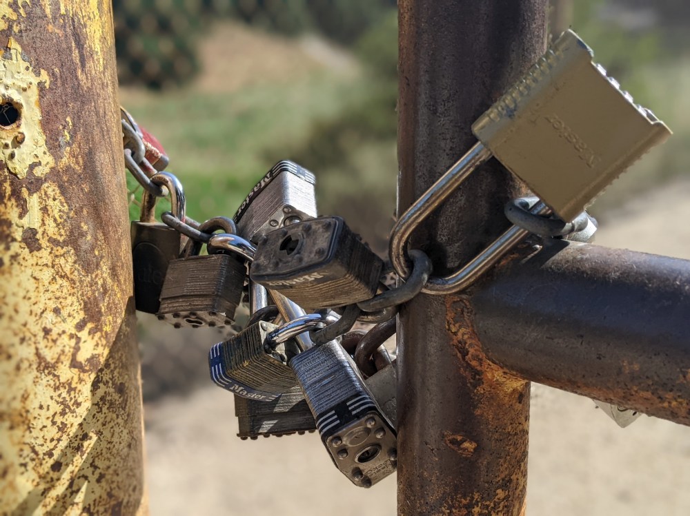
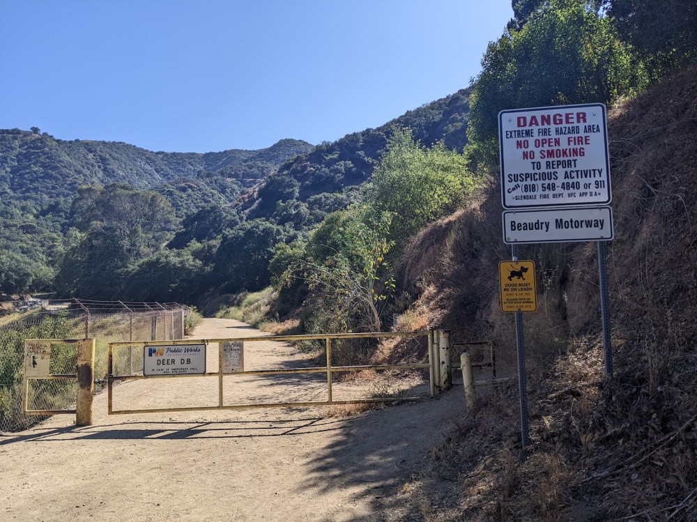
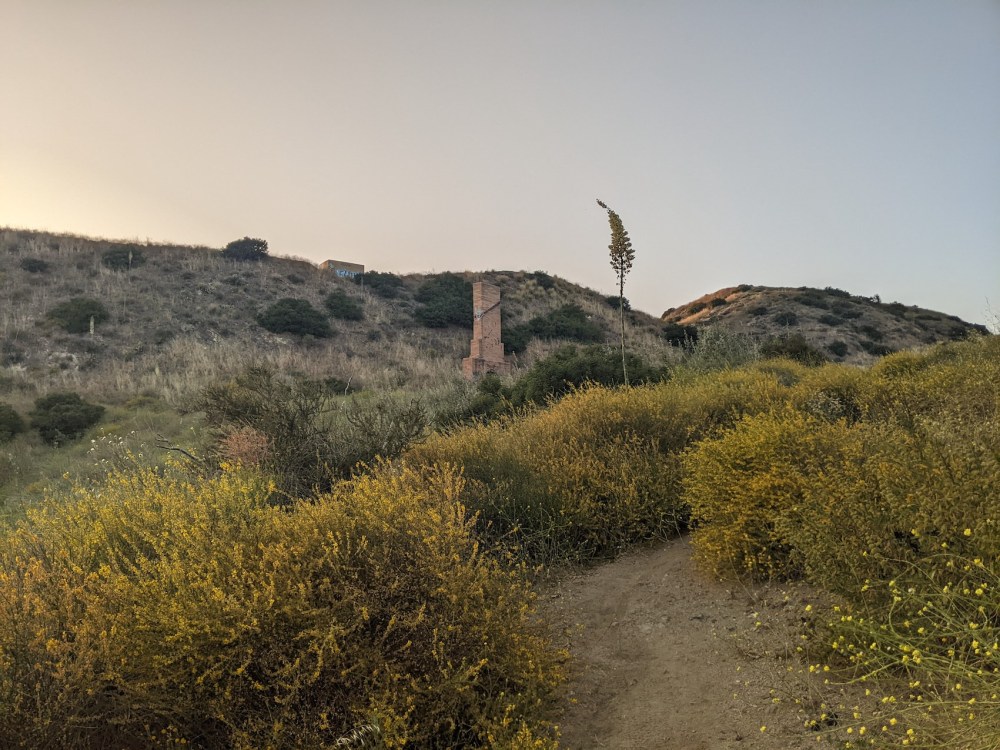
And here are some more pictures to go with the words. First, well-meaning but unloved signage:
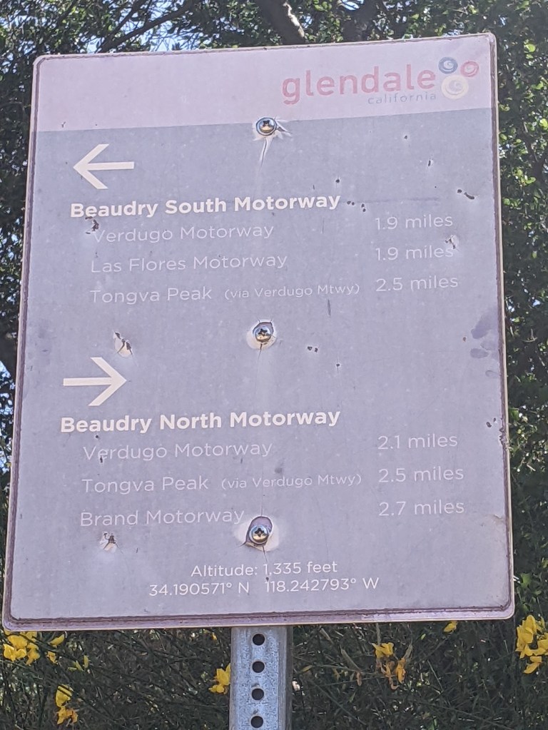
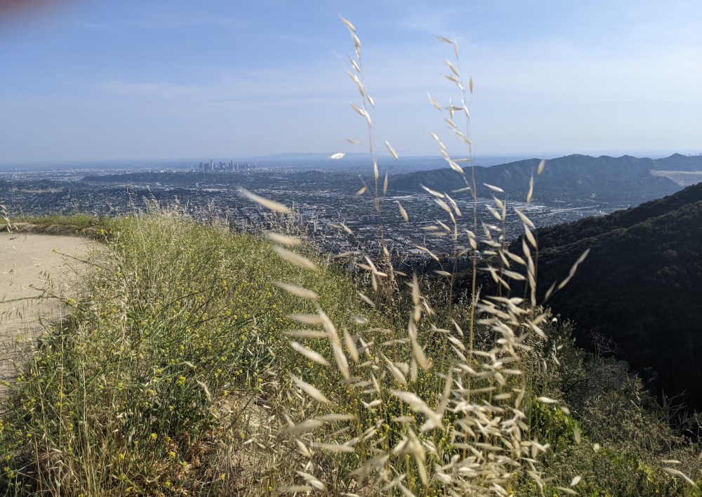
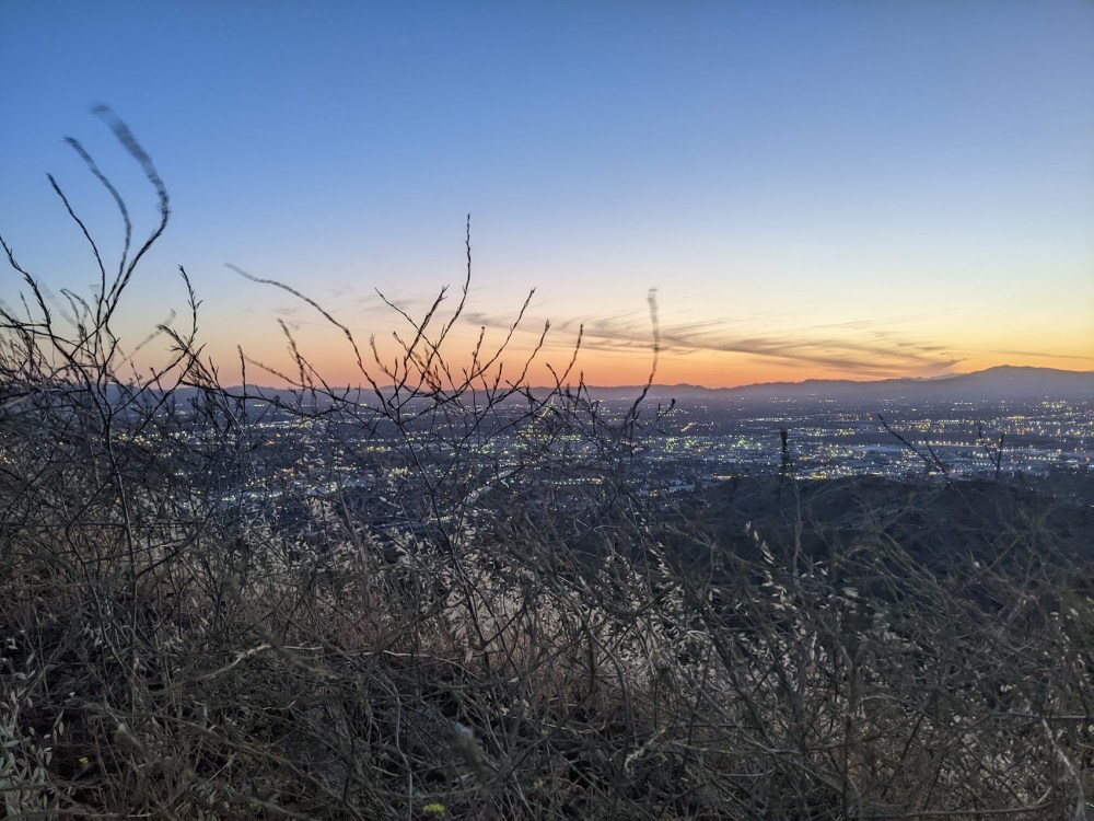
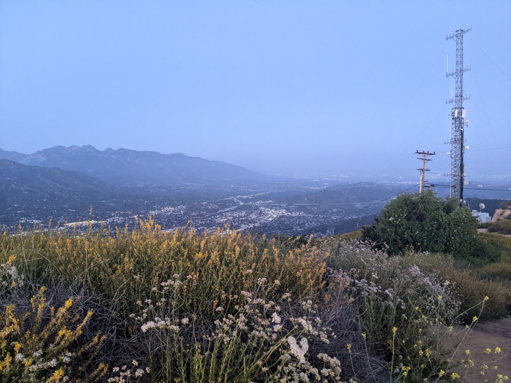
Views southwest over Burbank and the back of Griffith Park from just below the masts and above Tongva, near the northern end of the South motorway:
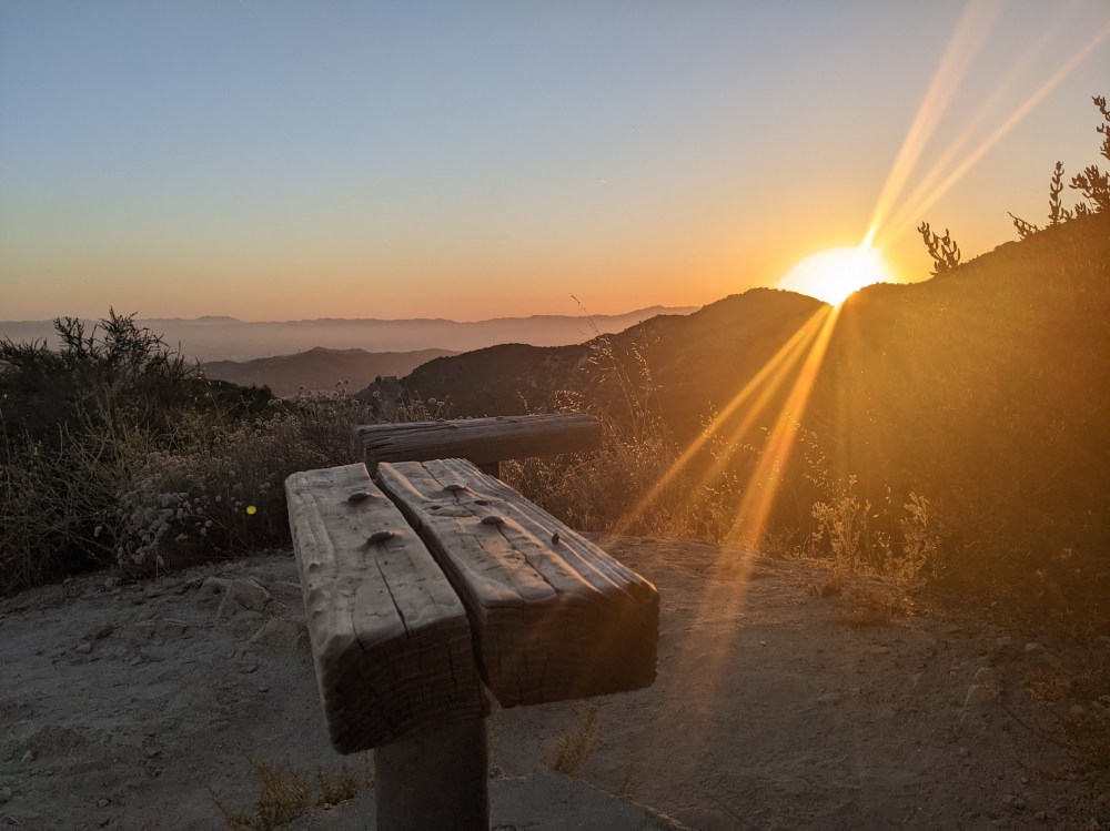
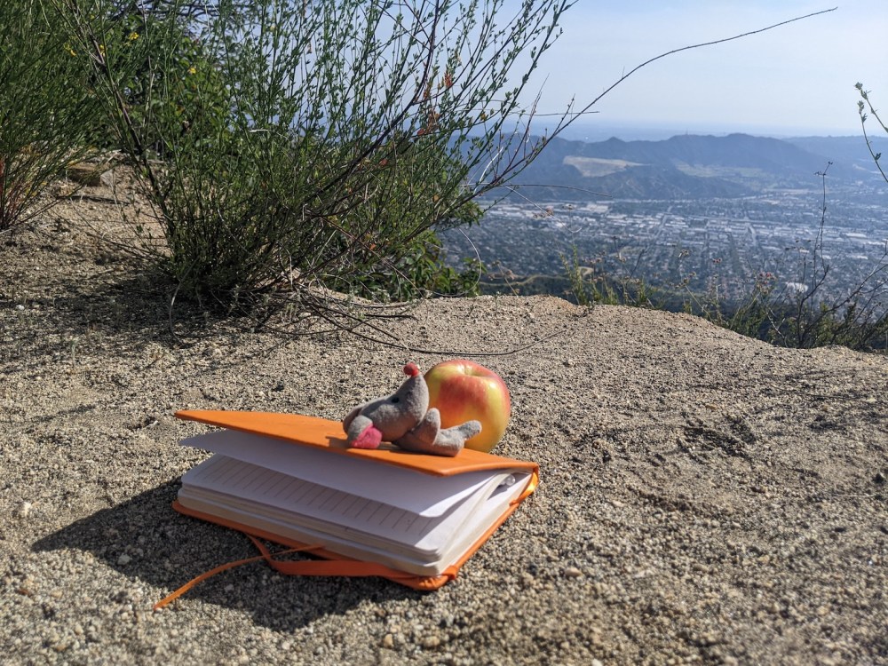
Good sunbathings for everyone:
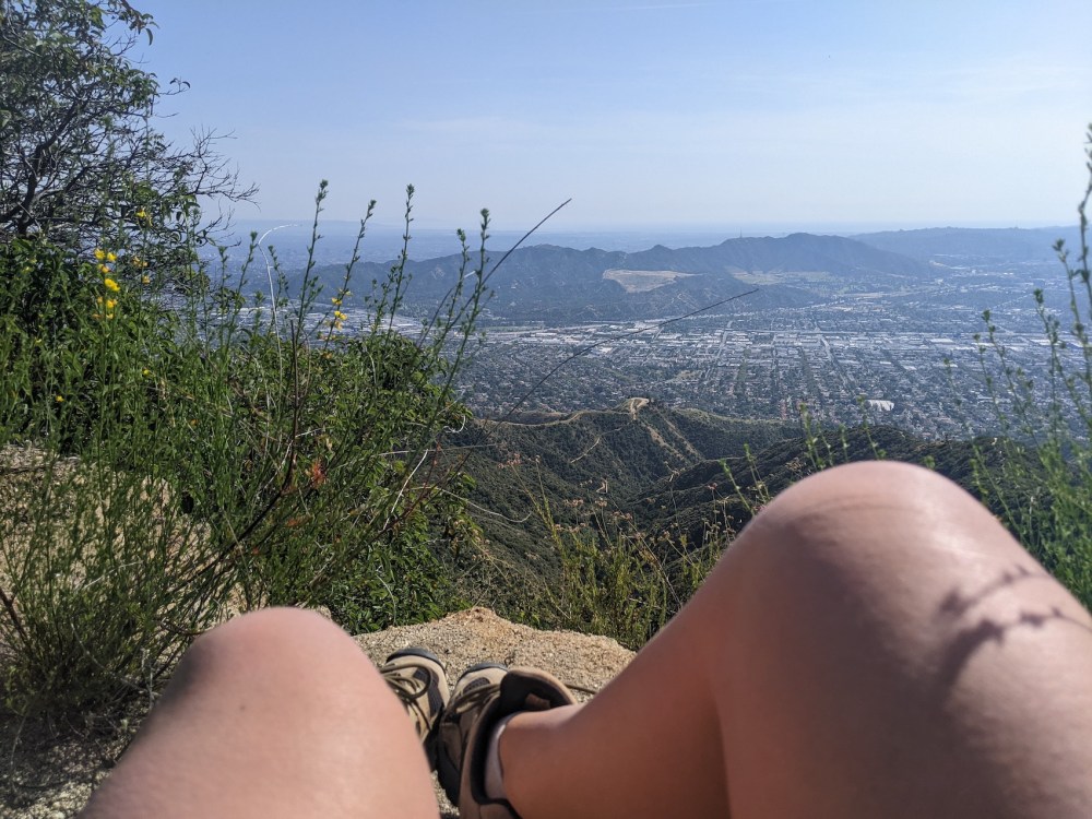
Gorgeous downtown views directly to the south on the way back down:

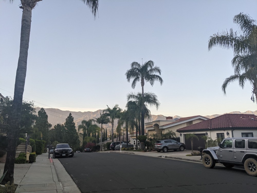
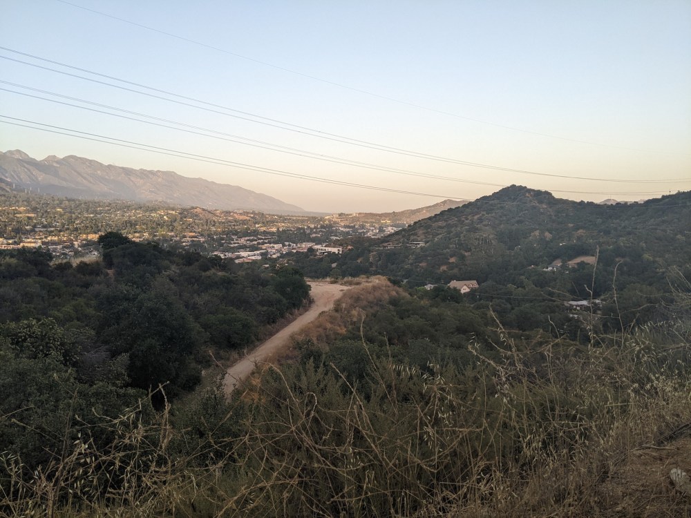
Views over the well-heeled Oakmont area where I was staying, with Montrose and La Cañada between it and the San Gabriels:

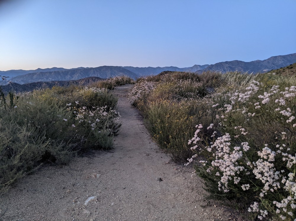
And those gorgeous California poppies I mentioned:
Beaudry South motorway
Feeling a bit wiped out by jet lag and a recent Arizona conference trip and the emotional turmoil of being separated from James, I did some shorter variations too. This was just a little one heading up the south instead of the north motorway and finding a stopping place 30 minutes up.
27 April 2022: I managed a shorter “lunchtime” hike—3 to 4:30, with two half-hours of walking and the half-hour in the middle sitting propped up against a water tank halfway up the South motorway. I ate the whole of a big protein bar as well as everything else, and then took as long to get back down as I had going up, feeling a bit knocked out then too.
Not many photos, just these fun appendages to the trailhead entrance:
And a view from the descent:
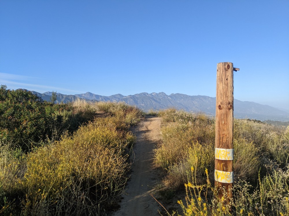
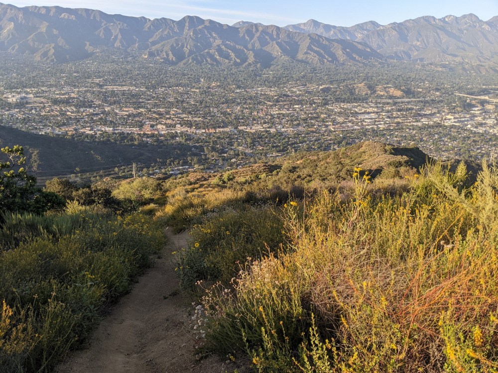
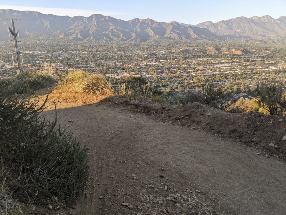
Beaudry trailhead to Oakmont View Drive via Verdugo Peak
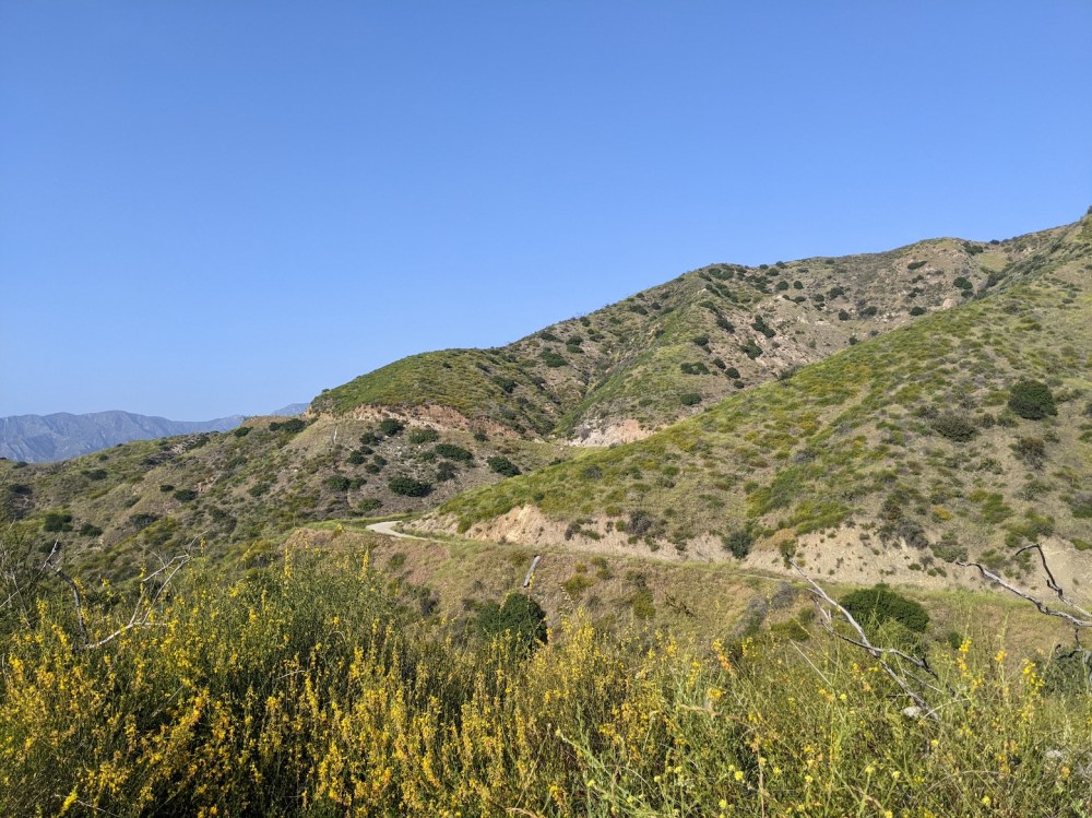
I took far too many photos on this one, possibly because I was pleased with myself for discovering a new way to circle back down into Oakmont, via a dodgy little path that most walkers would steer clear of.
From Beaudry trailhead you take the north motorway up to the masts where it turns into the Verdugo motorway (for me around 50 minutes), and follow that all the way to the peak, ignoring the left turns off down the Brand Park (60 minutes) and Skyline motorways (80 minutes), ignoring the second lot of TV masts just above the junction with the Whiting Woods motorway coming up from the right (100 minutes), and finally taking the hairpin bend up to the summit (110 minutes).
Then retrace your steps down to where Beaudry north and south split off from each other, and continue about 0.3 mile to a little turning off to the left marked by a wooden post. Keep left so you don’t take the undulating ridge but (about 5 minutes after the post) start heading precipitously downhill, until (after another 15 minutes) you come out onto a wide earthy track that almost immediately turns into a tarmaced track that then almost as quickly turns into a road—Oakmont View Drive, to be specific. I think the paved road is what Google has marked as Leviathan’s Teeth trailhead. Then for me it was just a few minutes on suburban roads to get back to where I was staying.
For me the whole loop from Beaudry trailhead to where I joined Oakmont View took almost exactly 3 hours—from 16:20 to 19:20 on a gorgeous late May day. It’s about 5 miles up and then about 2.8 back down to the wooden post and then less than 1 mile back down to the road, so you save maybe 1.5 miles by not wiggling all the way back down the North motorway. Though then if you left your car there, it’s just under a mile to get back there along roads!
So, I’ll now try to restrain myself with the pictures.
Not sure I’ve actually shared a proper clear picture of Beaudry trailhead, so here it is.
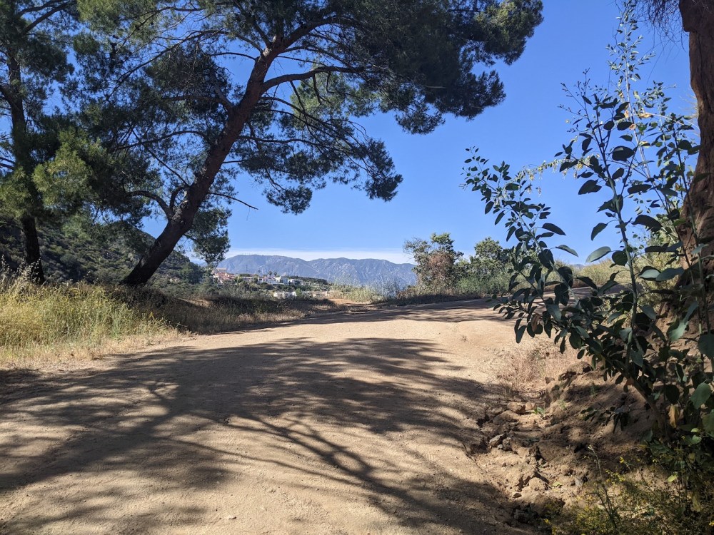
Feeling green and secluded and gaining elevation after only a few minutes.
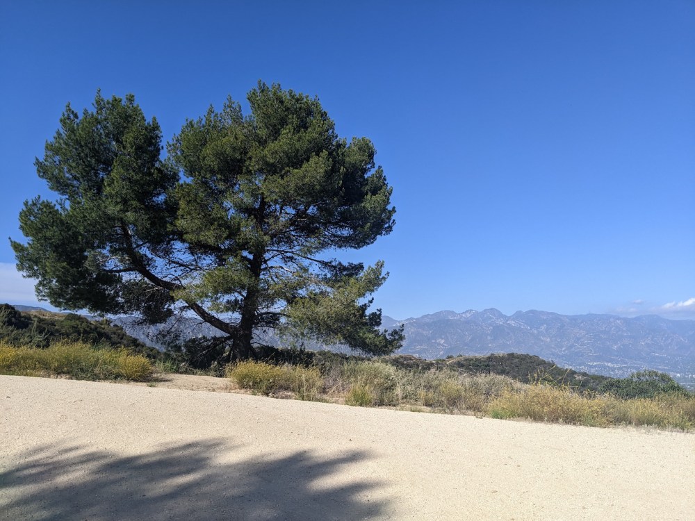
And an especially nice tree at just around the height where the San Gabriel views start getting enormous.
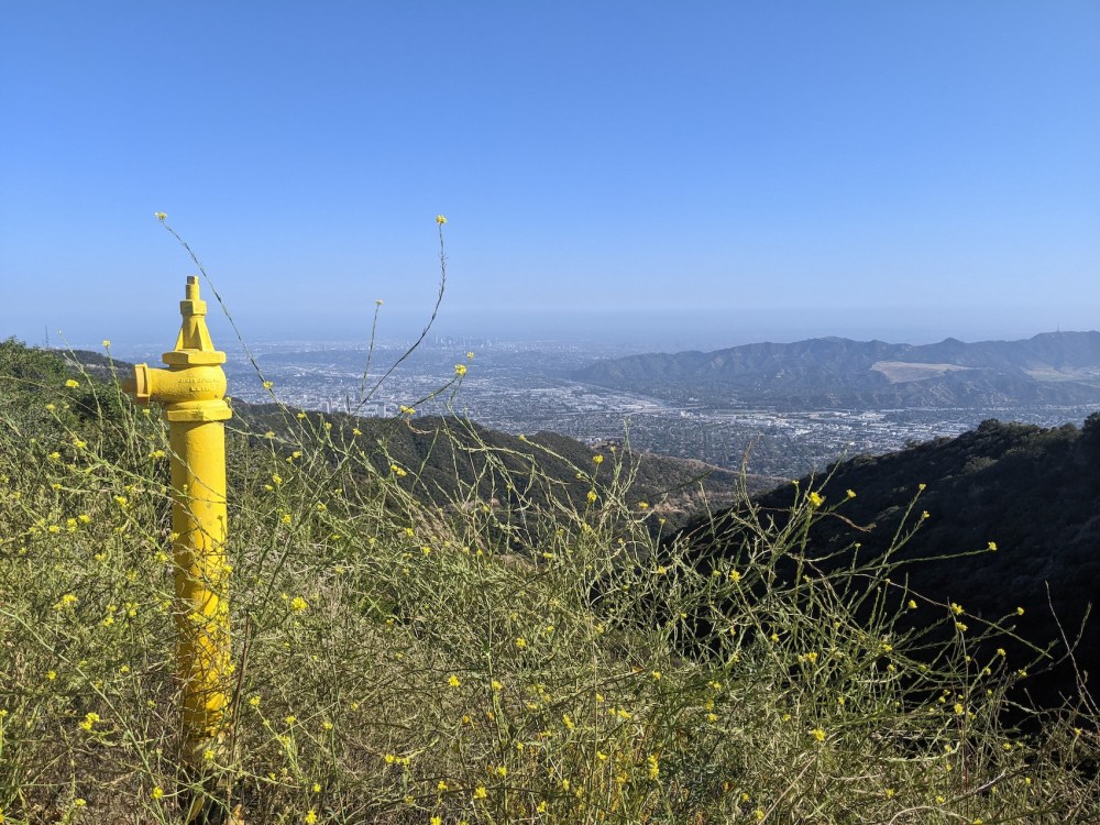
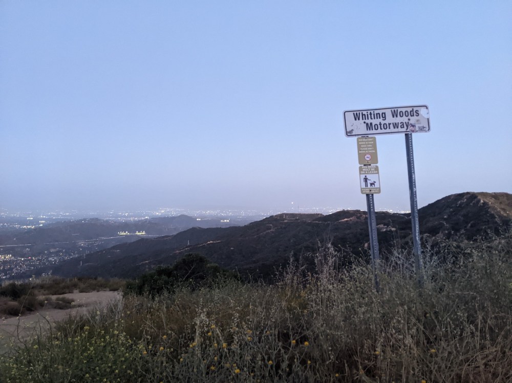
Picturesque street furniture.
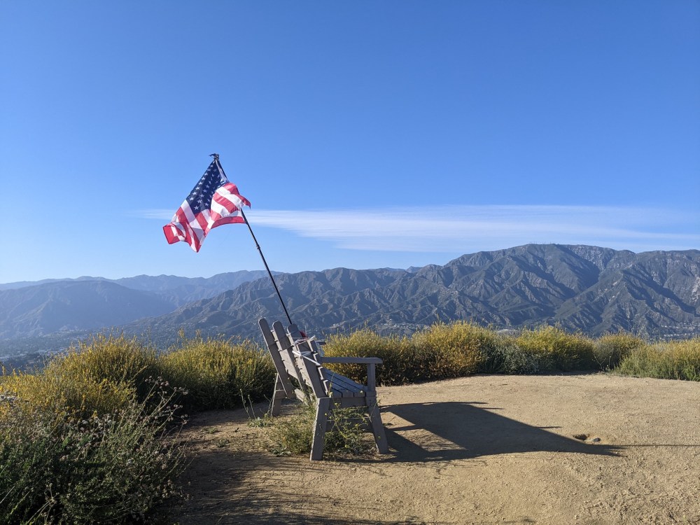
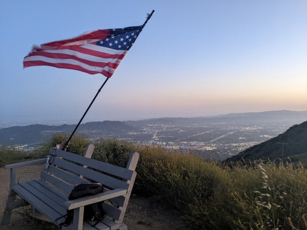
Picturesque patriotism at the peak.
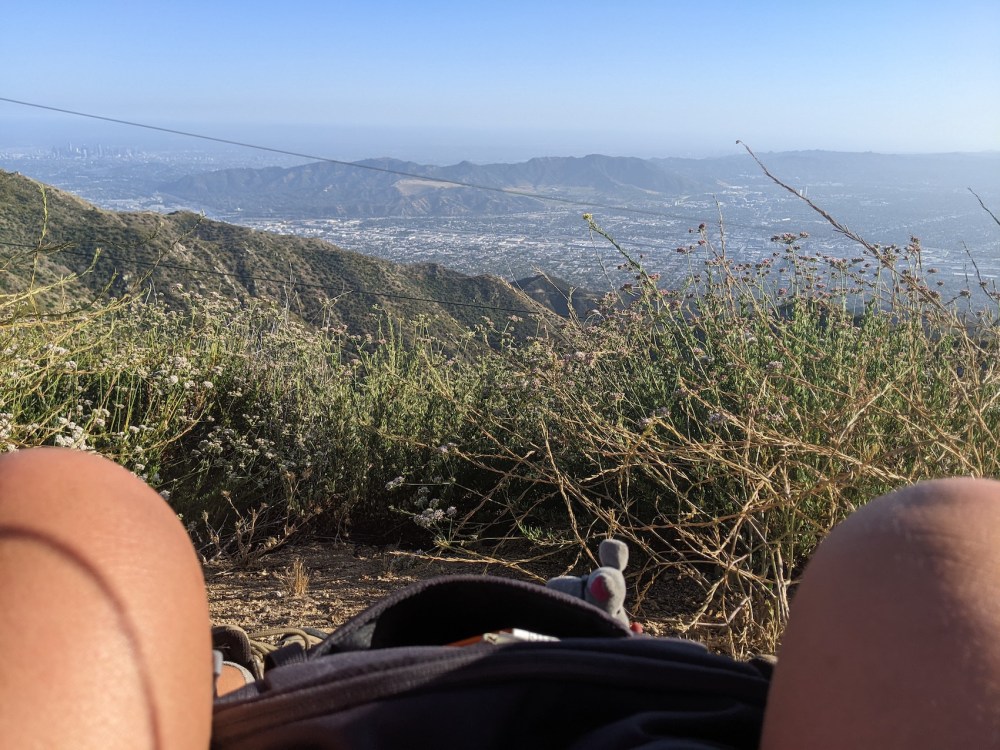
Stopping for refreshments above the city haze.
The post marking the shortcut trail back down.
Starting to get steep.
Levelling off onto the track.
Back onto tarmac (and graffiti).
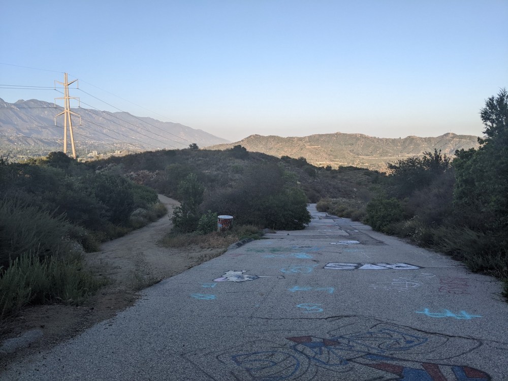
The border with civilization proper.
And my favourite kind of suburbia.
Stough canyon #1
For this one, you start from the Stough Canyon Nature Center: there’s parking there, and you can also park anywhere along the road (the very top of E Walnut) by the golf course. Then simply follow the fire road, officially Stough Canyon Mountain Way, up to the junction at the top. As the map shows, you can also peel off to the left to make the ascent a bit longer and wigglier:
This one was a contributor to my decision to stay an extra fortnight, it seems, after a driving range session failed to happen…
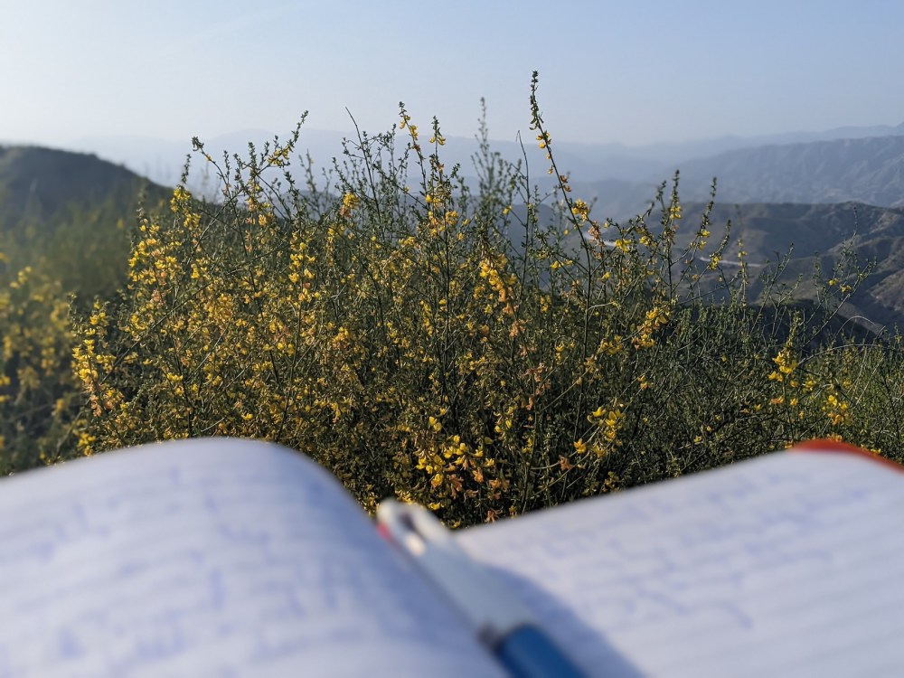
3 May 2022: Yesterday afternoon didn’t quite go to plan: […] at DeBell they were filming some movie, so I went for a mini hike instead, up to the saddle there, the way we came down after the full loop with Simon back in 2017. [I now realize I never wrote that one up!] It was actually very lovely and also very productive. I’d read the survey feedback [I was gathering views on my Design Your Dream Morning course] earlier on, and someone had said, in “what would you change or add”, guided meditation. I found myself musing on that as I walked, and coming up with what at least at the time felt like a really nice satisfying sequence on the balance between accepting and wanting, as applied to “today”. I hope it will seem as good when I type up the long messy notes I scribbled right on top amongst the nodding yellow flowers (must find their name). Then the drive back, all along Mountain St with its hundreds of stop signs, was nice, and a fitting domesticated context for pondering the “want” I’d had really powerfully, up on the hike as the ideas were flowing and this ordinary Tuesday early evening was turning into something rather cool in the way that only LA allows—I want to stay here longer. Can I make that happen?
The view from my perch on a little knob just west of the saddle at the top of Stough canyon, possibly called La Tuna viewpoint.
Looking south from my knob, back the way I came:

Looking west along Chandler fire road:
And east along the Verdugo motorway:
Finishing my scribbling:
And setting off back down the same way:
Stough canyon #2
A couple of weeks later, with my extension successfully booked, I returned to take the other route up Stough to the same little lump where I’d done my writing before—the slightly longer option shown on Google Maps above, past the Old Youth Camp. I gather that that was a mid-20th century Scout camp, burnt down by a wildfire that, like the recent ones that destroyed parts of Altadena and Pacific Palisades, left only the foundations and the fireplace intact.
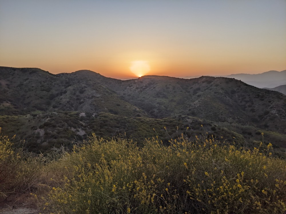
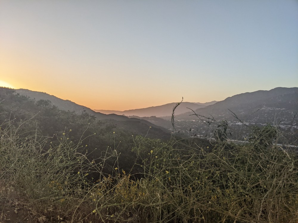
I was there in the early evening leading up to sunset around 19:45, and it was lovely watching the light change on the yellow blossoms of the black mustard plant—the invasive species that may have helped fuel the boyscouts’ fire—and turning all the mountain browns to pinks.

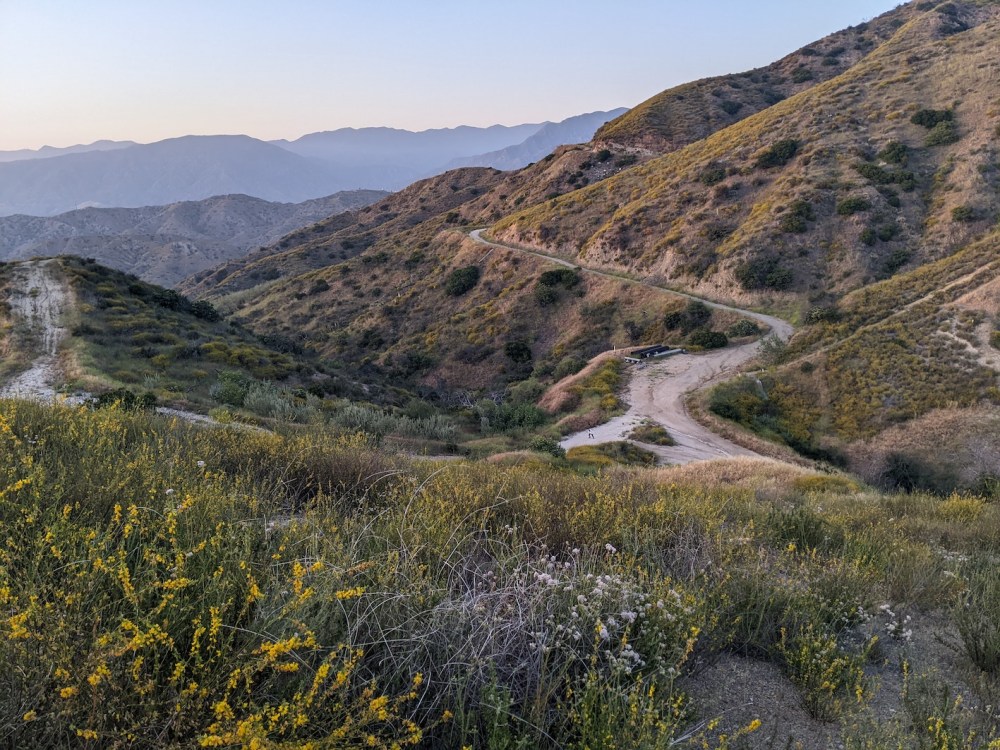
La Tuna Canyon trail
I have no records of the details of this evening hike, but I started at La Tuna Canyon trailhead (easy parking at the top of Village Ave, as I recall), and I think I went along La Tuna trail to the junction with the Chandler fire road, and then took a left and continued as far as my Stough Canyon knob or thereabouts, before heading back the same way in the remaining daylight.
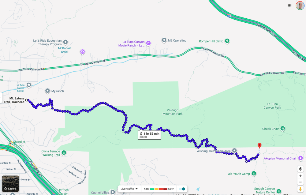
Now I look at the distances, this seems like further than I’d have squeezed in on a random Wednesday evening, but in any case, this would make sense as a route to try! Or shorten it by starting from Olivia Terrace trailhead to the south instead.
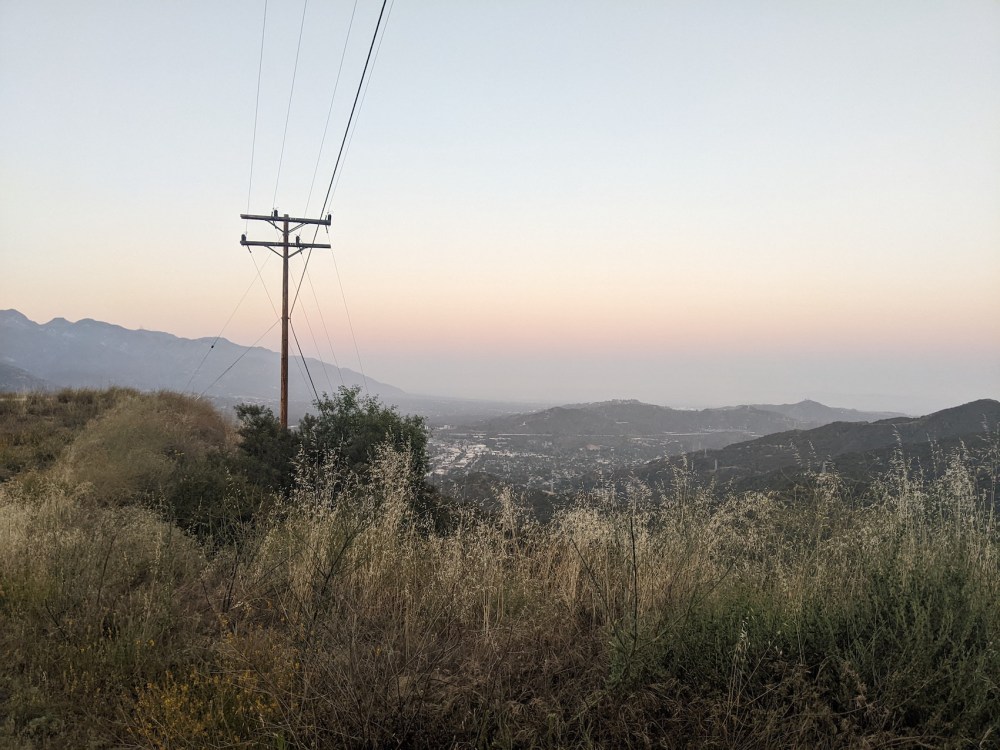
Some pretty sunset views on the return leg:

And turning back onto La Tuna from Chandler:
Burbank and its airport coming alight before nightfall:
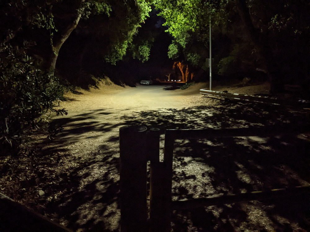
Whiting Woods to Verdugo Peak
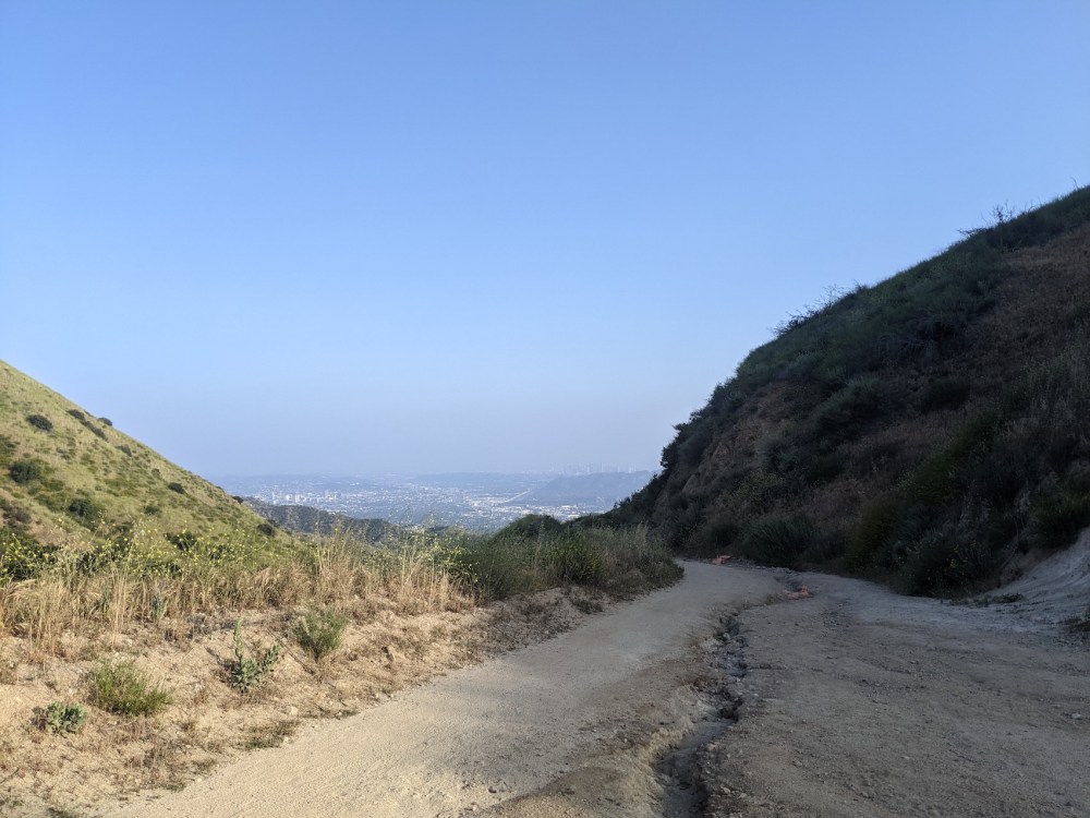
I am very much not a runner, but this sunset hike turned me briefly into one.
31 May 2022: I thought I’d have a very early night, but ended up starting a hike from Whiting Woods trailhead at 19:20 and underestimating the time to the top; I think I vaguely assumed half an hour or so, and it was actually exactly an hour. It was beautiful up there post-sunset, but the dark came quickly, and I was glad of my bike light to help make the jog back down safer. It struck me so forcefully how much this place changes my life in all the most specific ways that make all the difference: Imagine ending up going on a jog after dark in Oxford! It just wouldn’t happen, or if it did, it would be because for some reason I forced myself to do it. Not heading out to walk in the evening because it’s so beautiful I’m almost in tears looking at the mountainous silhouettes, and then running back down just because that makes most sense.
The route is simple: all the way up the Whiting Woods motorway from the trailhead, then turn right up to the peak. And it appears I was a lot quicker than Google’s estimate, managing the 3 miles in an hour. I think the way back down took me about 35 minutes at gravity-aided jogging pace.
Here are some snaps of the fading light on the way up to the peak.

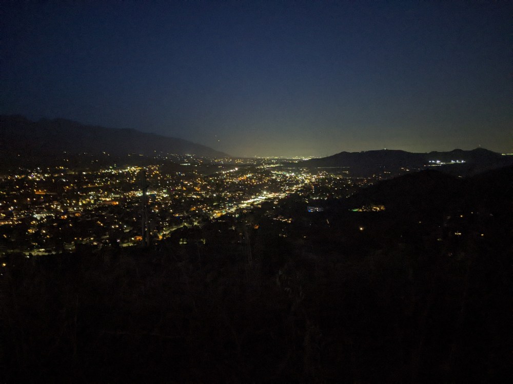
And then the switch from light to dark came quickly, between 20:23…
…and 20:45:
And a firmly nighttime trailhead at 20:55.
Deukmejian Wilderness Park
Strictly speaking this doesn’t belong in my Verdugos roundup because it’s in the San Gabriel foothills, perched just north of La Crescenta. But in my mental map of ways and times of hiking in LA, it fits in the exploring-Verdugo category. I’ve only ever been here once, and the evening I did so (2 June 2022) was a bit of a blur thanks to some emotional drama earlier in the day. I came here to escape, and to calm myself, and it worked in both senses.
I have no idea exactly where I walked, once I’d parked in the main car park and set off in whatever direction seemed most appealing. From the metadata of the few photos I took, it looks like I came back along Le Mesnager trail. But anyway, it is beautiful there, especially around sunset; I recommend going there in whatever kind of mood you find yourself, and letting your feet choose the path.