Distance: around 10 miles (16 km)
Time: 4.5 hours (including a nearly 1-hour picnic stop)
Elevation gain: approx. [according to Google Maps] 1,673 feet (510 metres)
Difficulty: terrain-wise and navigation-wise, easy; fitness-wise, moderate
Drive: Don’t! You can also skip the roady parts altogether if you like, by taking a golf buggy to the start of the fire road. To my endpoint and back along the fire road alone would be around 6.6 miles and 3 hours.
Rattlers spotted: none
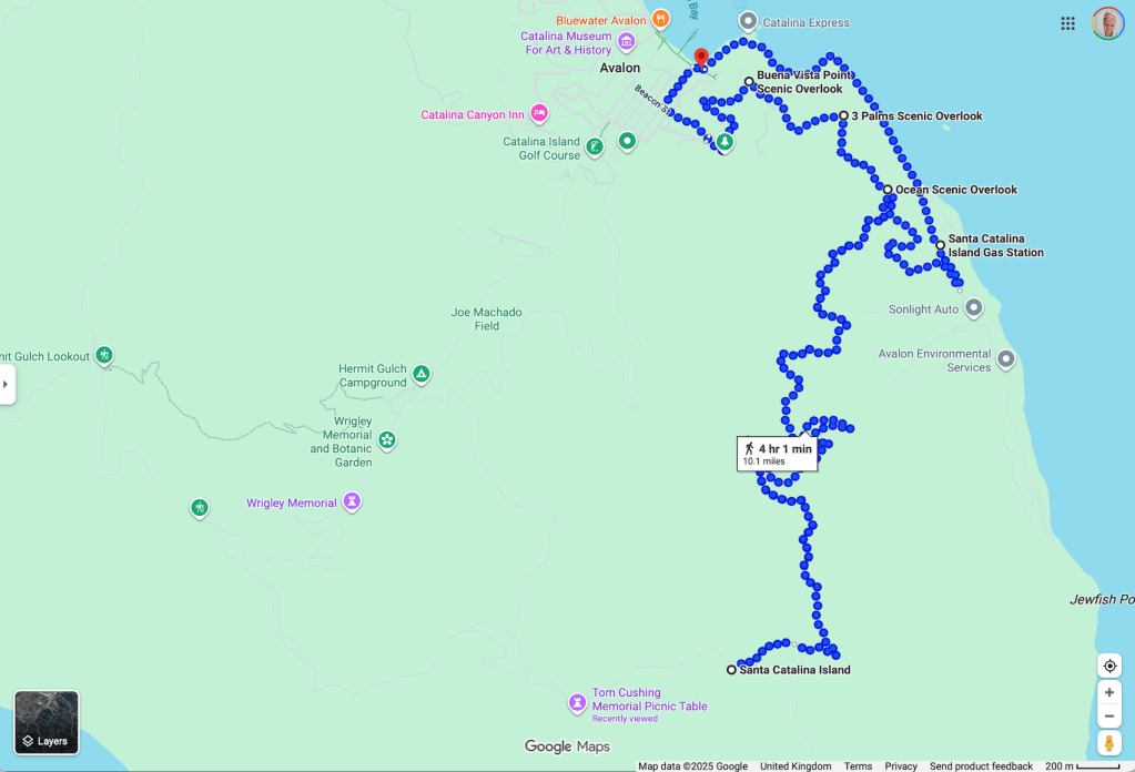
Here’s an overview on Google Maps, starting and ending at the appealingly named Pancake Cottage and taking a more sensible route than I did for the first little bit up to Wrigley Road.
This was my first time on Catalina: my first time setting foot on an island that’s been so often glimpsable, over the years, through the ocean haze from the city and the mountains, so rich with conflicting images of wealthy weekend playground and island sanctuary.
And it was a strange weekend of plans gone awry and beautiful things happening nonetheless. My former lover* V was running the Catalina marathon and invited me to join him—for the trip, not the running.
(*a phrase used by my mother to describe the man she was intending to marry, before calling off the wedding six weeks before)
Coming in from Santa Barbara on the 101, the traffic was horrific even for LA, and after hours on the 405, I deposited my Mustang at the Budget Long Beach drop-off and caught a taxi to the port, arriving with minutes to spare before the ferry left.
Here she is looking rather fine in the last of the sunset.
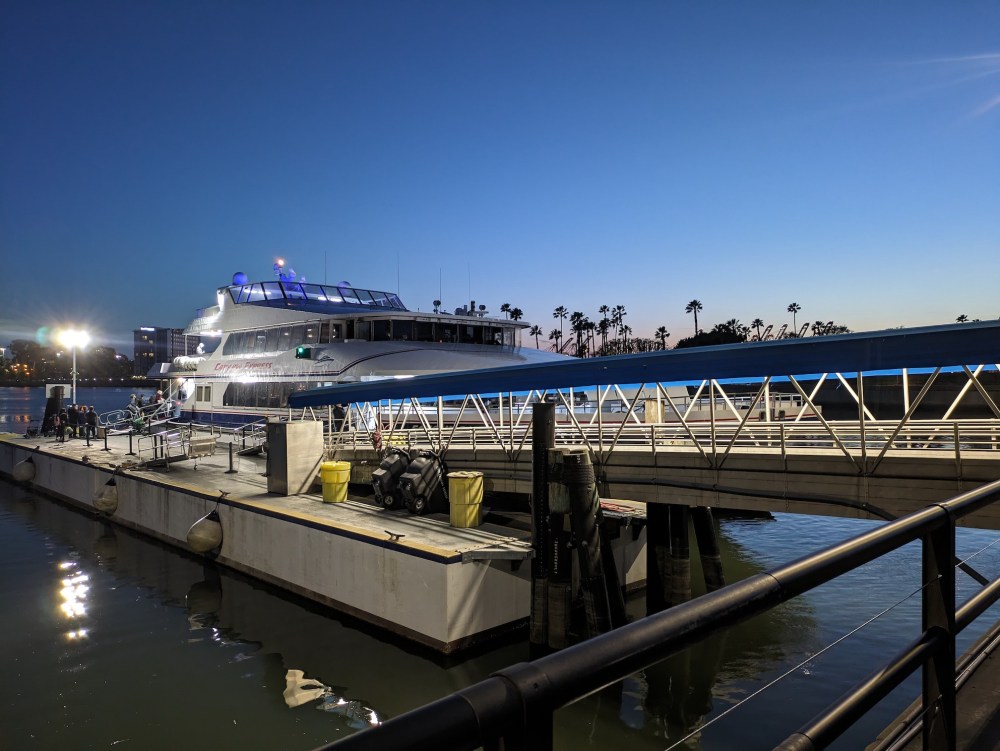
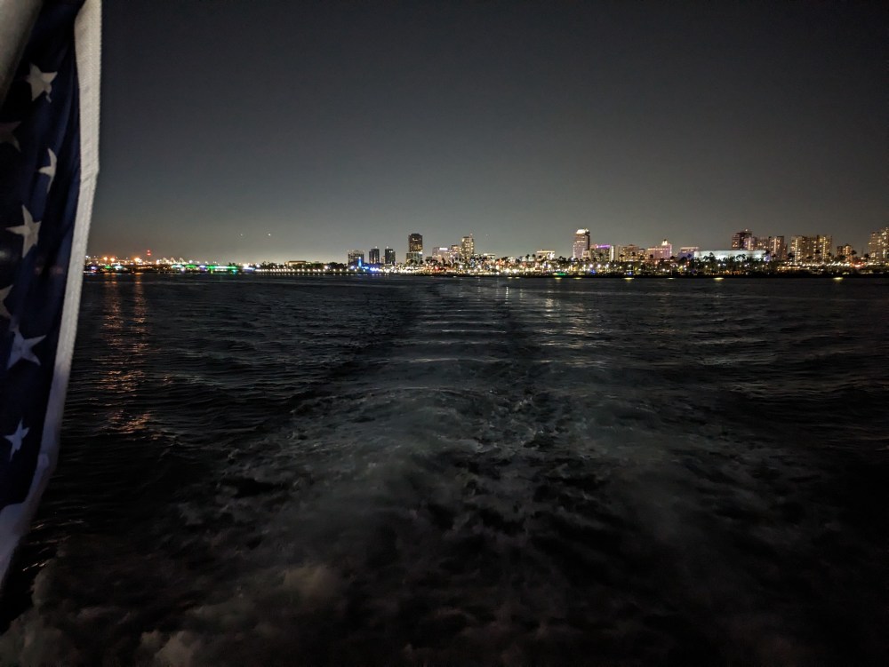
V was coming from Glendale and arrived just too late, so he had to work out some special midnight alternative for contestants. So I spent the crossing on deck on my own, first watching Long Beach grow dark…
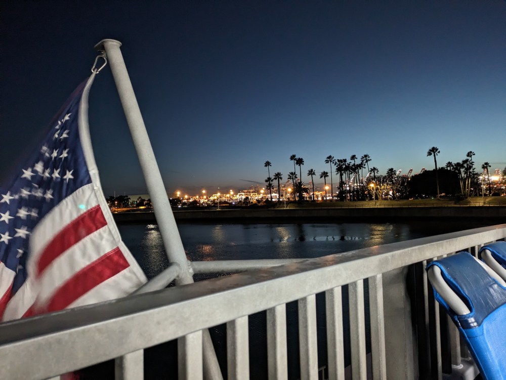
…then getting a good view of the Queen Mary…
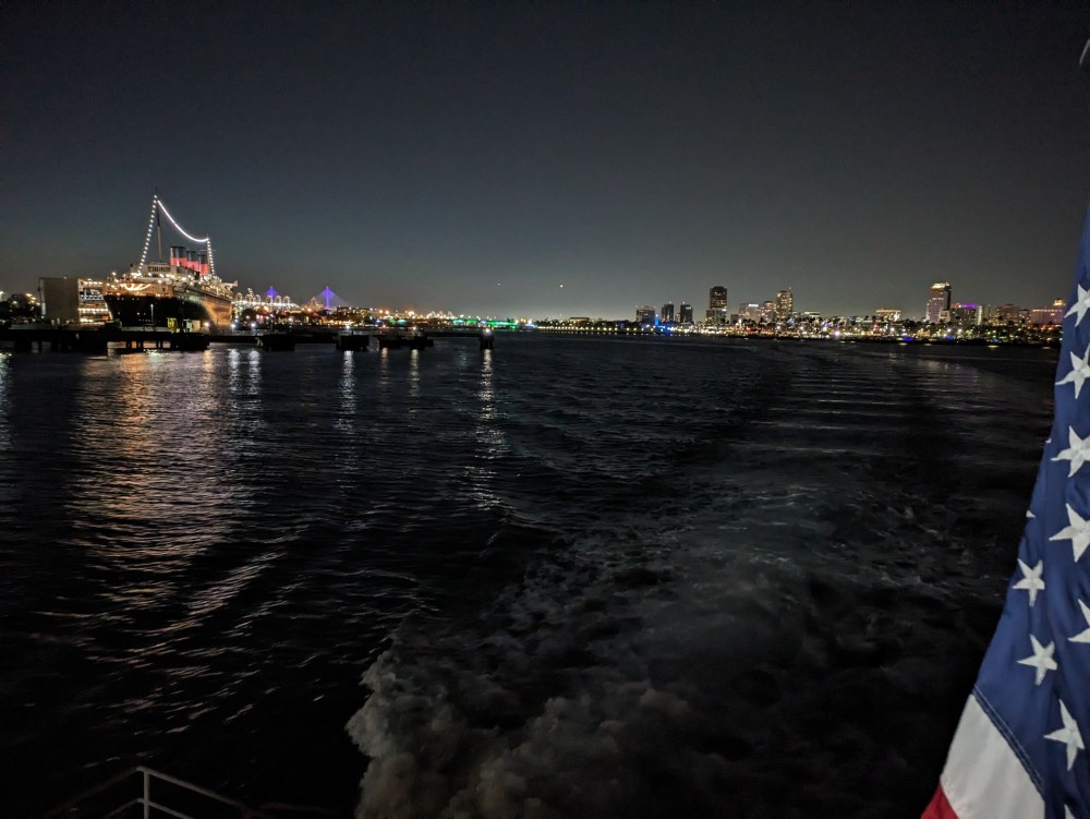
…and finally watching Los Angeles recede into the east for the first time ever.
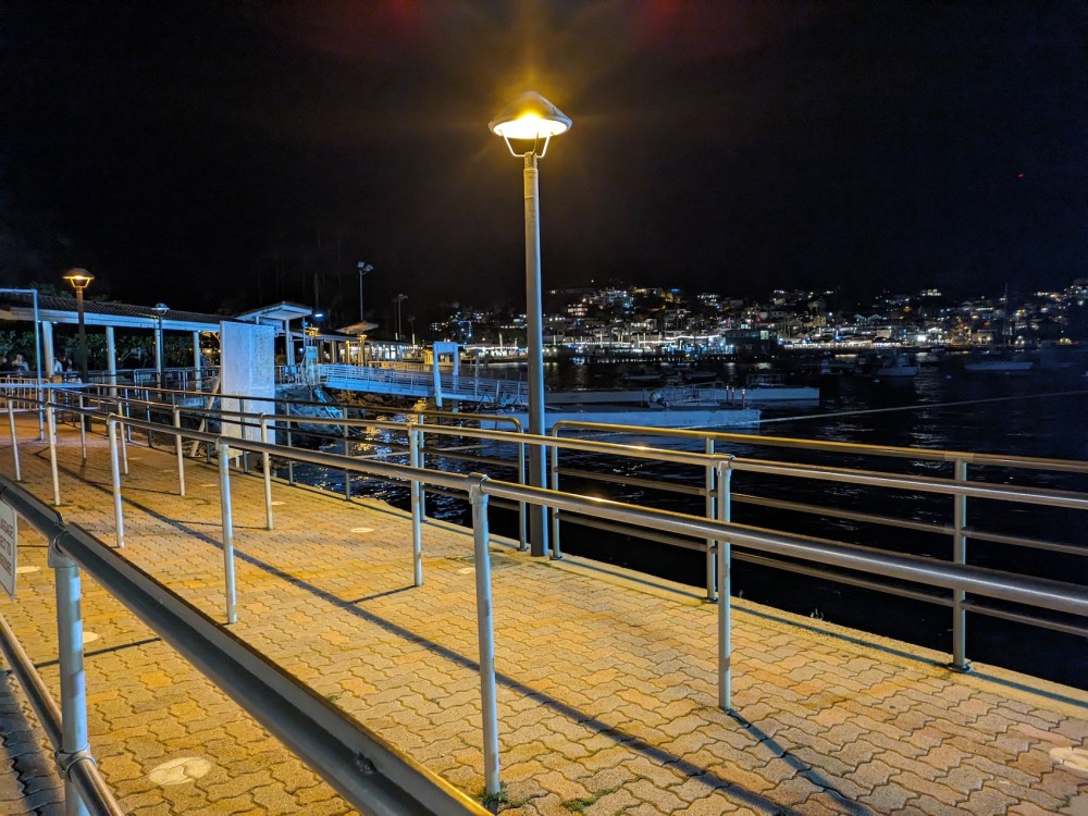
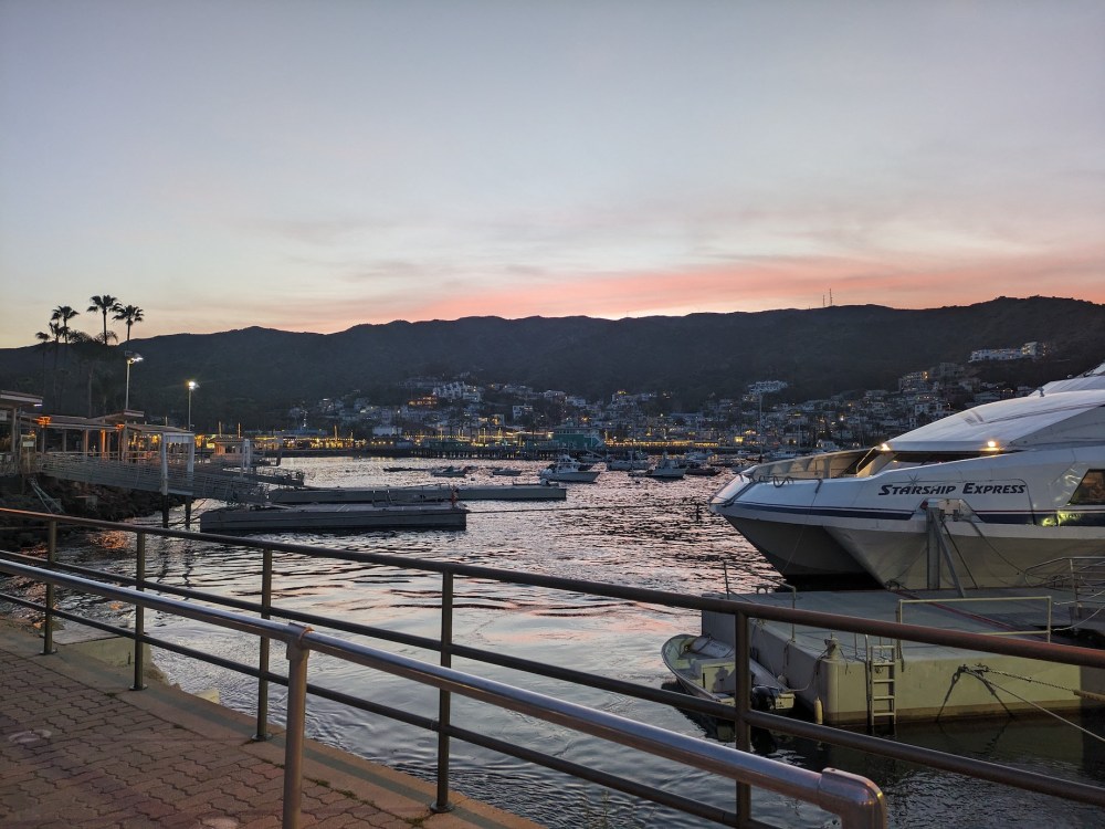
An hour or so later, we docked in Avalon.
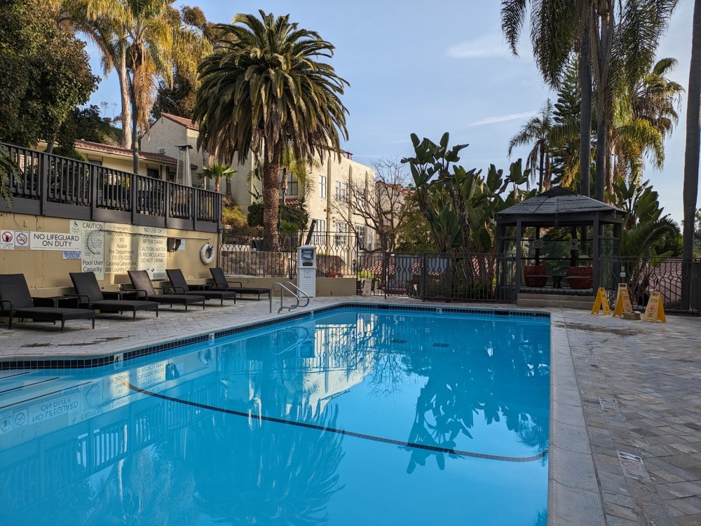
And after a solo Friday night at the Catalina Canyon Inn, I woke myself up with a nice swim in a still-silent pool.
After hodgepodge hotel-bed picnic-making, I set off to deposit my luggage (I was en route to New York) at a place by the ferry and then try an improvised hike from the centre of Avalon. I wanted to make sure to be back in time for V’s triumphant crossing of the finish line around lunchtime, so I did some perusing of Google Maps and worked out a simple route that looked doable.
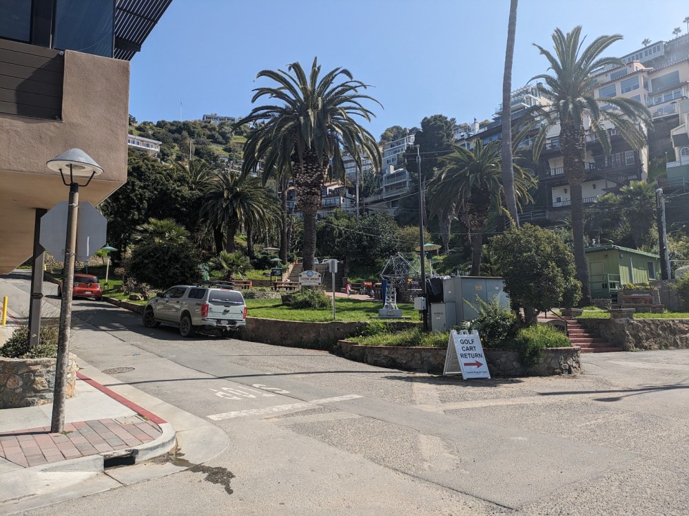
Here’s what felt like the start: the junction of Pebbly Beach Rd and Clarissa Avenue, aka the southernmost corner of Avalon harbour. I took these helpful orienting photos at the end rather than the beginning, but here they are. I think this is officially called Avalon City Park: a sliver of palmy green by the golf cart rental.
Head up the street here, and you get to some steps:
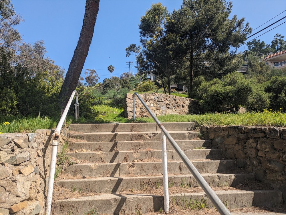
And then you get to a steeper bit of path that looks like you’re probably going through someone’s garden but you’ll probably get away with it if it’s stayed how it was for me. If you persevere (you can also just take the longer way round by the road, as shown above!) you come out onto one of the streets that curls up to meet Wrigley Road, which then winds its way around the contours of the hill until the houses run out.
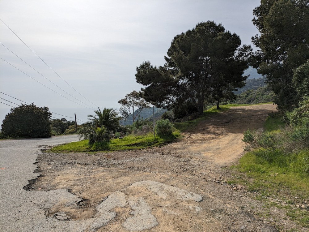
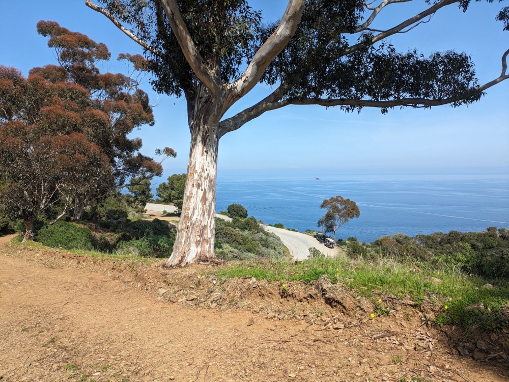
After passing the Mt Ada hotel and what Google calls the 3 Palms Scenic Overlook, you get to the unimaginatively named Ocean Scenic Overlook, and this is where the East End Light Road starts.
Not many East End London vibes!
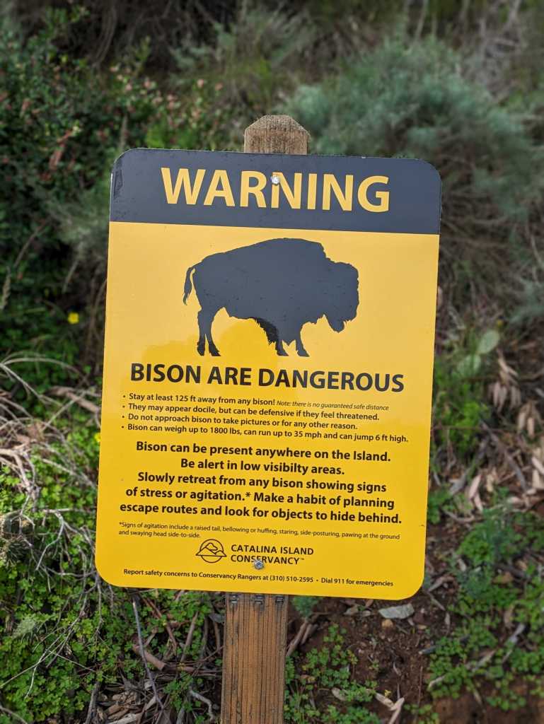
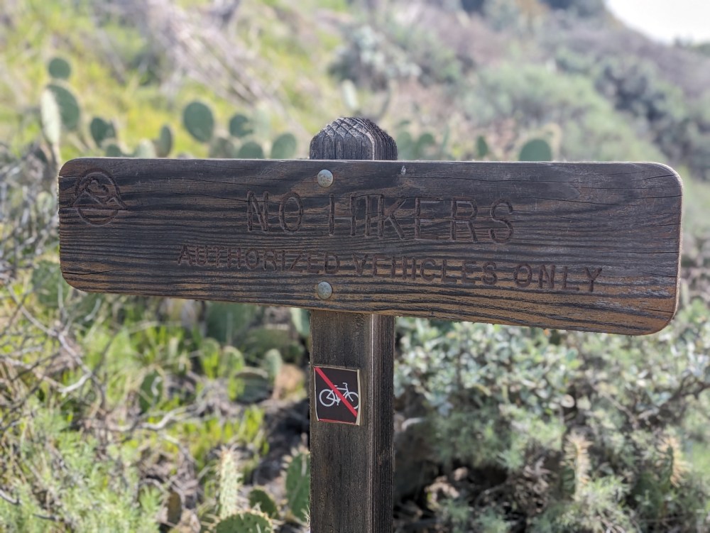
The helpful signage starts with a bang.
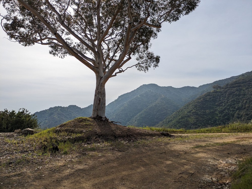
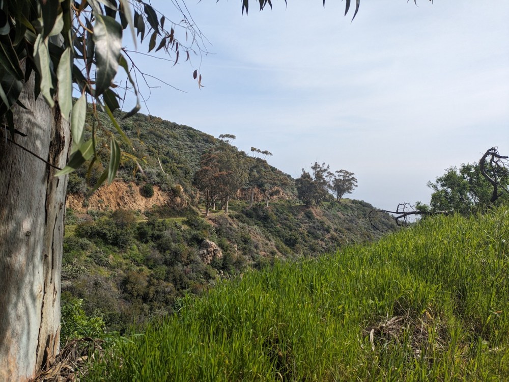
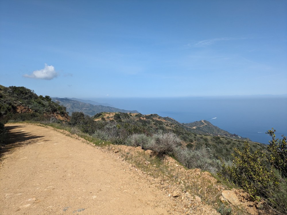
And immediately, the eucalyptus-studded views from the fire road feel more expansive and remote than those from the ordinary road, maybe just because of the absence of concrete.
Always nice being able to look back the way you came.
Half an hour and 1.5 miles after leaving the road, at the first sharp hairpin bend, another helpfully unambiguous sign.
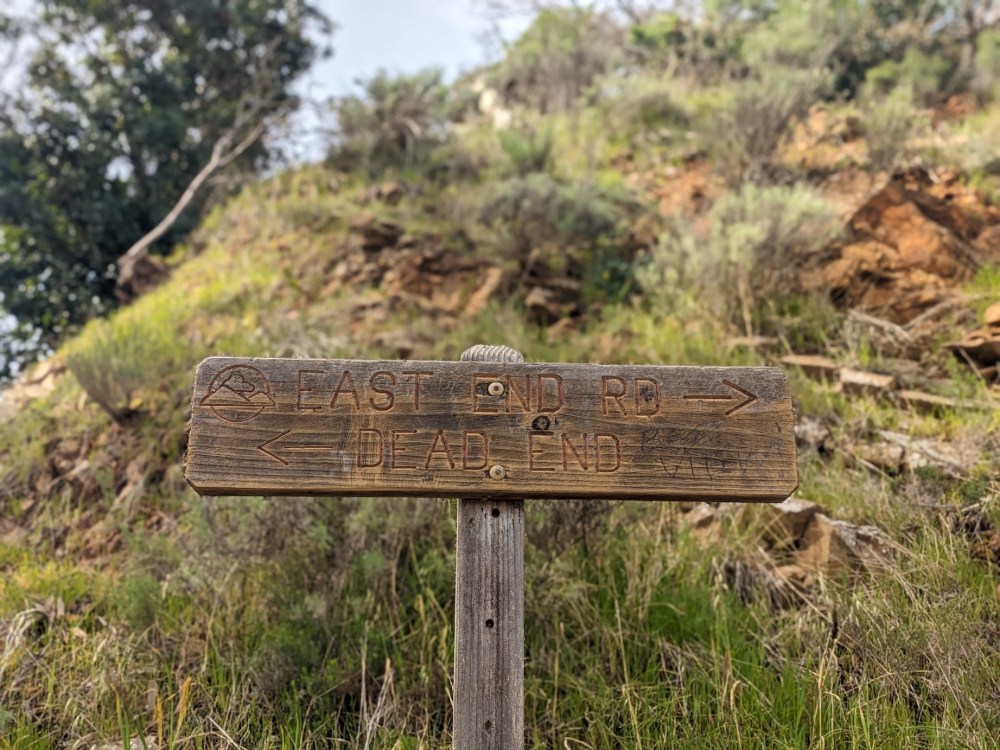
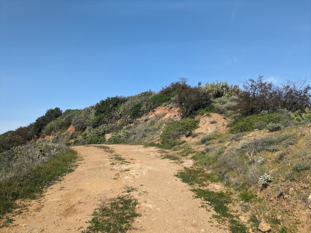
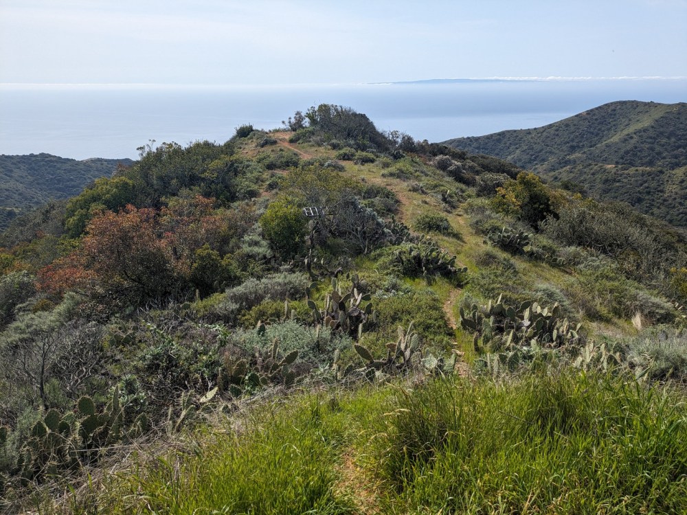
Having opted against the dead end, another half-hour brought me to the literal highpoint of my hike.
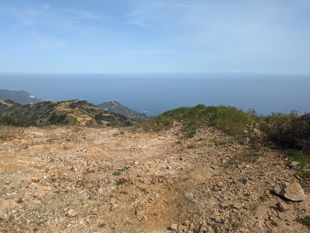
Wonderful to see Mt Baldy all snow-capped across the San Pedro channel to the northeast.
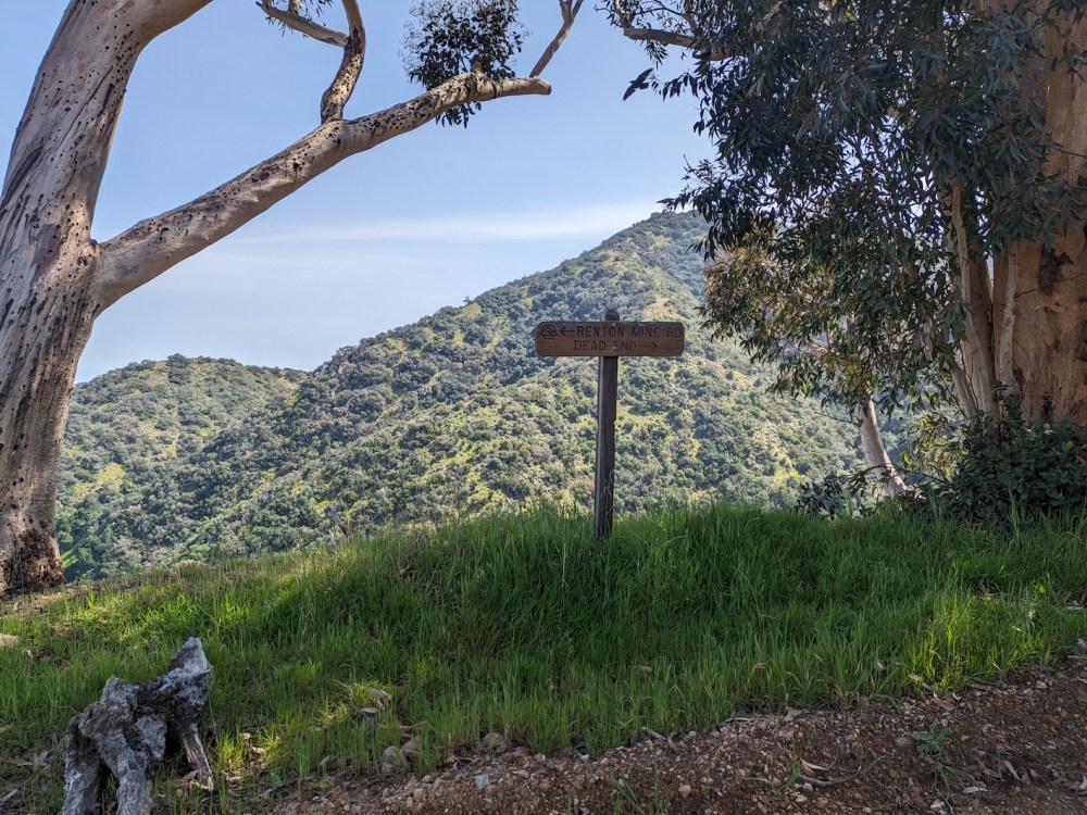
Turning my sights westward again, another couple of minutes and I was at the junction of East End Light Road and Divide Road, being quietly hectored by signage again.
Obediently leaving East End and continuing west along Divide Road for five more minutes, I spotted a tempting little path leading south. It was 10:50 by this point: high time for brunch.
Following the path to the small knob you can see here gave me a lovely rocky picnic spot with views across to San Clemente Island.

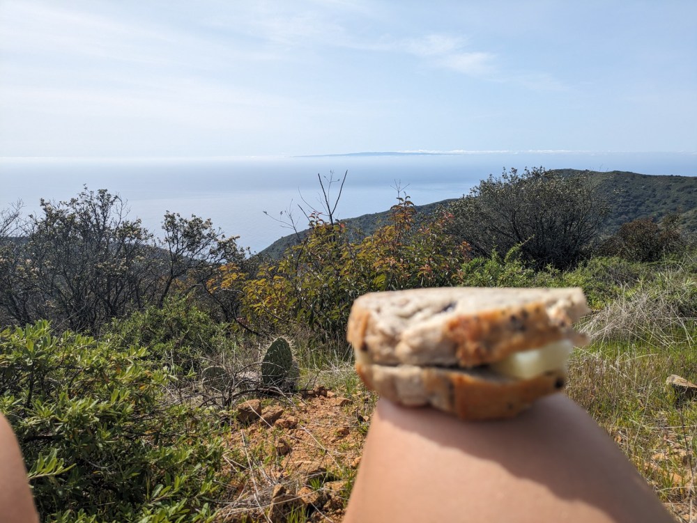
I spent almost an hour there, eating, drinking, sunbathing, and typing. I think this was the first time I’d ever brought my laptop on a hike, and it was rather nice to spend half an hour writing down some blog post ideas I’d been having on the way up, which turned into a miniseries on letting go (see the first post here if you like). I also jotted down a few meta-notes on “contingent creativity”, which may or may not turn into something fully-formed one day.
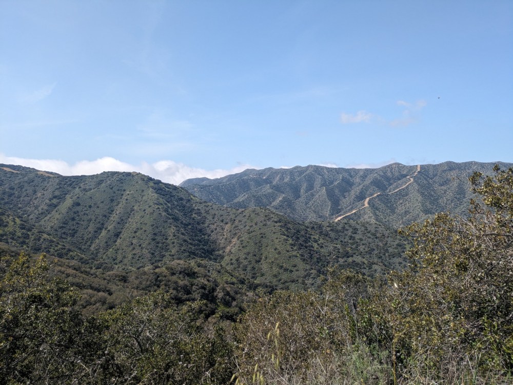
So I was back to the main track at 11:50, with the San Gabriels and the San Bernadinos looking even more magnificent now some of the morning haze had burnt off. (Human eyes and brain obviously worked better than the camera.)
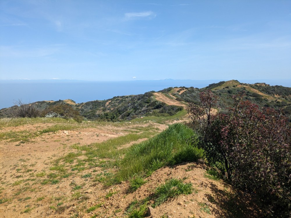
And as so often, the views felt quite different this way round: lots more sea…
…and more steep green inland slopes, too.
Just one more uncomplicated sign.
And then, an hour after leaving the picnic spot, I was back to the road.
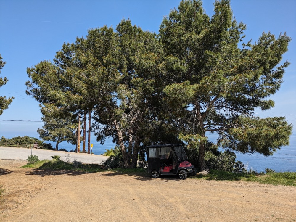
Someone else had taken the easy option for getting to the trailhead.
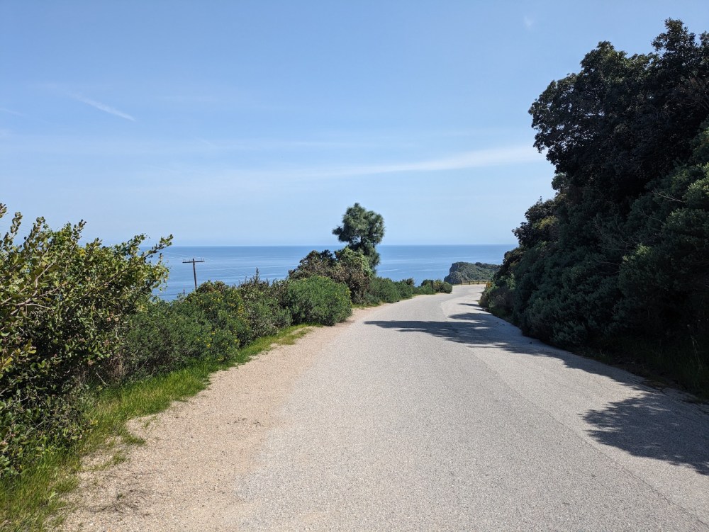
Now I turned right along Wrigley Road and followed it along and down to where it meets Pebbly Beach Road at sea level.
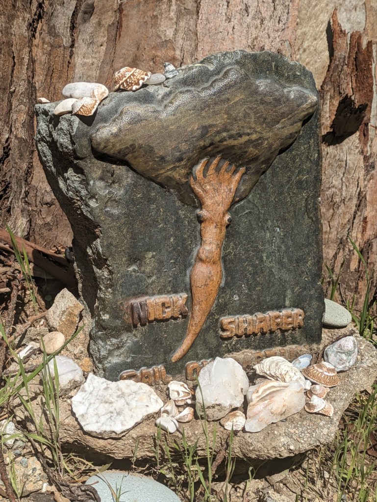
I passed some great big Canary date palms and some excellent memorial art.
And in only 10 minutes I was down in the world of power stations, boatyards, and waterside restaurants.
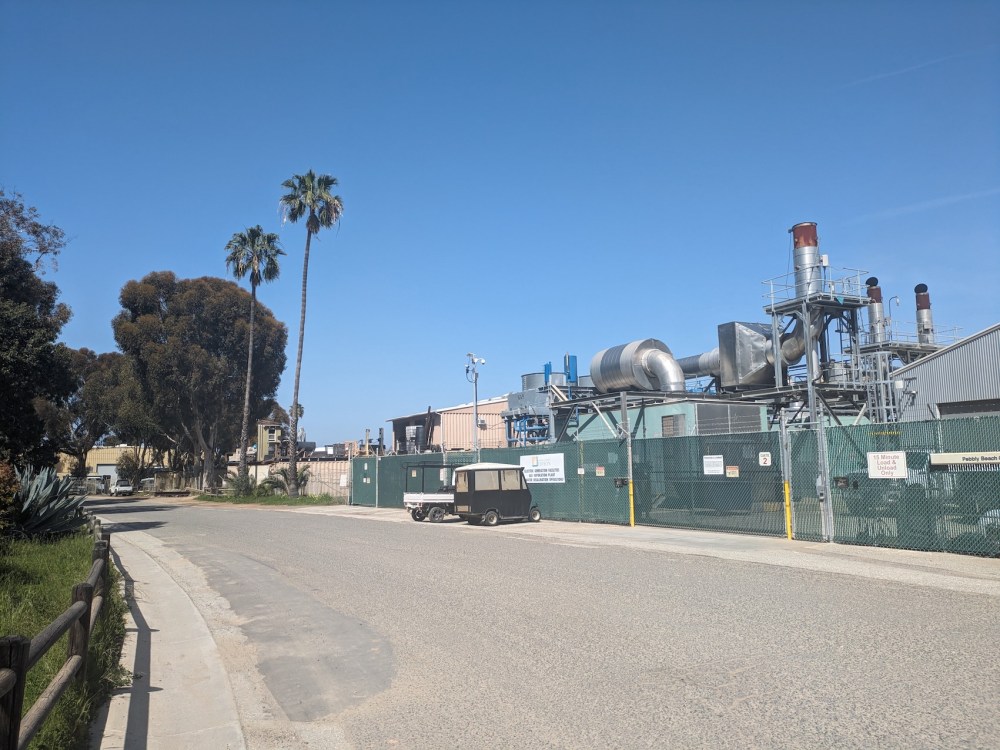
It was interesting passing by the light-industrial underbelly that powers the sleeker parts of Avalon, and then I enjoyed a nice seaside stroll along a road that seems rarely walked along.

25 minutes from the scenic overlook where I’d rejoined Wrigley Road, I was coming round the corner for a good view of the harbour and the casino that should really be something artier.
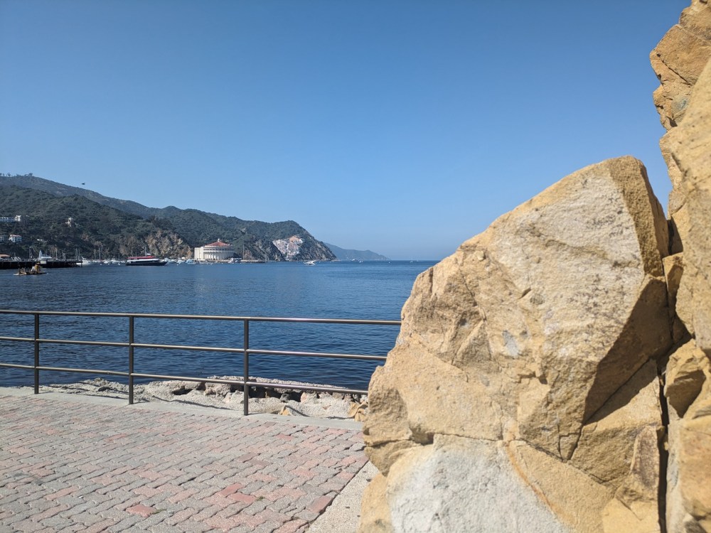
Also good views out towards Long Beach to the northeast where the ferries come from.
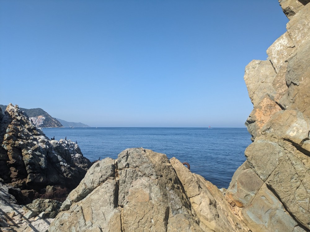
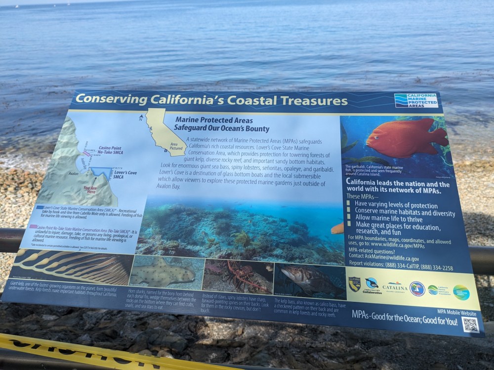
And some nice wildlife info for the fittingly named Lover’s Cove a few minutes further round.
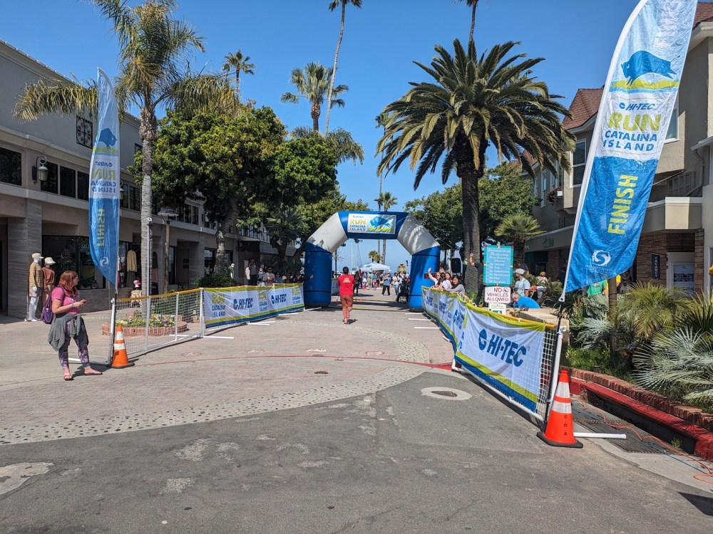
I was back in town just in time to buy some cold cans of drink and head to the finish line.
After that, the weekend took a less outdoorsy turn, with beer and Jäger shots at the Marlin’s ship-shaped bar, followed, at Steve’s overlooking the harbour, by breaded coconut prawns, sea bass, ribeye, and a pinot grigio / sauvignon blanc blind tasting that we both failed.
Then it was already time to get back to the Catalina Express, and to watch the island receding into the west.
The trip ended with an adventurous pedestrian crossing (complete with suitcase!) of an enormous Long Beach bridge that in the daytime would be a death trap, to the Queen Mary car park where V had left his car.
This route is doubtless far from the finest that the island has to offer, but if you want something simple that you can start on foot right from Avalon, and you care about big open sea views more than you do about challenging trails, then you could do worse than start here. I hope I’ll get the chance to follow it up with something wilder some day!
